More eyes in the sky: NRO building new satellites to deliver ‘10 times more signals and images’

WASHINGTON — The National Reconnaissance Office is on track to dramatically increase the number of spy satellites it relies upon to collect intelligence, the agency’s deputy director Maj. Gen. Christopher Povak said Oct. 10.

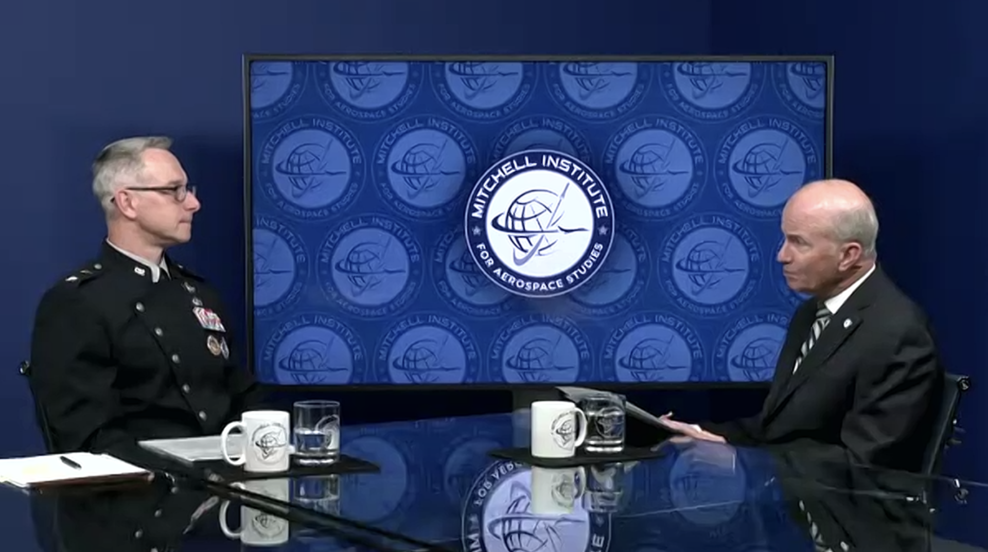
Speaking at the Mitchell Institute for Aerospace Studies, Povak offered further insight into the agency’s plan to grow its constellations of satellites for imaging, signals intelligence and reconnaissance. 

The NRO, an intelligence and defense agency, builds and operates an unknown number of classified satellites that collect intelligence for U.S. policymakers, military commands and other organizations. The director of the NRO Christopher Scolese earlier this year revealed the agency set a goal to quadruple the number of satellites it operates over the next decade and move to a more “proliferated architecture” of different size satellites in more orbits.

Povak on Tuesday said these new satellites “will deliver over 10 times as many signals and images as we’re collecting today.”

“The proliferation and diversification of our architecture will provide increased coverage, greater capacity and resilience and more timely delivery of data,” he said. The diversity of assets will make it more difficult for adversaries to harm the U.S. intelligence infrastructure, Povak added.

Responding to competitors

The NRO is increasingly relying on commercial imaging satellites but is also building more of its own assets in space partly in response to the growing capabilities of rival nations, he said. 

“Competitors across the globe are posing unprecedented challenges and eroding our technology advantage at a rapid pace,” Povak said. 

“China in particular is closing a technology gap,” he added. “They’re investing significant money, manpower and resources to challenge America’s dominance in space, developing increasingly capable military space systems, a troubling array of sophisticated and lethal weapon systems, all enabled by space, and a growing arsenal of anti-satellite capabilities.”

China and Russia are developing ground and space-based weapons specifically designed to interfere with or destroy U.S. systems, he said. These weapons include ground-based missiles, electronic jammers and cyber attacks.

“We’re answering these challenges by advancing the capabilities we put in space and on the ground,” said Povak. 

The new satellites the NRO expects to deploy over the next decade, he said, “will create more persistent coverage over any area of the Earth, provide faster revisit rates and increase the accuracy and fidelity of our data.”

“Our investments will increase the survivability and strength of our systems by shoring up single points of failure, addressing vulnerabilities on the ground, in the cyber domain and on orbit,” Povak said. 

The NRO also is buying small satellites for experiments to “rapidly assess new technologies in the space environment and test new concepts of operations on orbit,” Povak said. “This ‘pathfinder’ strategy is already reducing our timelines for deploying future operational systems.”

‘Responsive space’

Povak said the NRO is watching U.S. Space Force efforts to speed up the timeline to launch space missions, under a program known as responsive space.

“Responsive space to us means that we want to be able to be prepared to launch a payload as soon as that payload is ready,” he said. 

It also means having access to multiple launch providers and launch sites to deploy a diversity of spacecraft ranging from the traditional schoolbus-size satellites so smaller platforms built with commercial satellites buses “that we can integrate new payloads on.”

To be able to meet the goal of quadrupling the number of satellites, the NRO is shrinking the production cycle, said Povak. “Instead of taking six to eight years to create one specific satellite, we’re now producing multiple satellites every year.”

source

Keeping track of rehabbed wild turtles isn’t easy

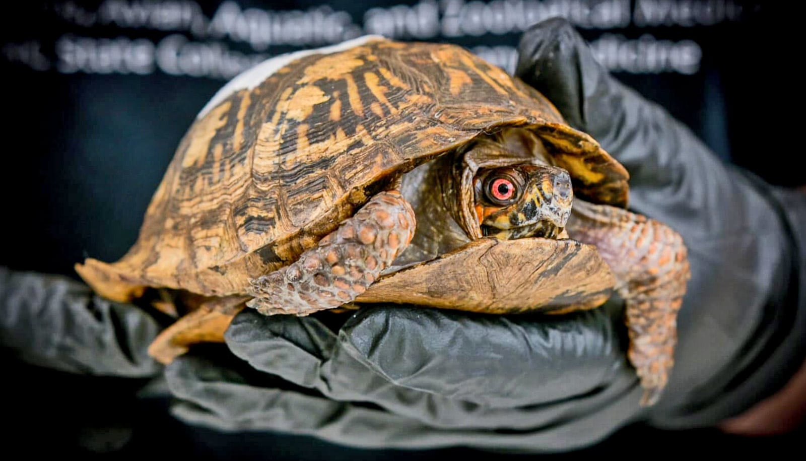
When a wild turtle recovers from an accident and is released back into the wild, what happens next? Finding those answers can often be just as challenging as saving the turtle itself, researchers report.

The Turtle Rescue Team (TRT) at North Carolina State University is an all-volunteer operation run by veterinary students that sees over 600 wild turtles, reptiles, and amphibians each year. On average, approximately half of the animals admitted annually are successfully treated and then released back into their home environment.

“As a volunteer organization, we don’t really have the resources or means to track all of these animals and discover what their health outcomes might be in the long term,” says Sarah Zurbuchen, a graduate of NC State’s veterinary school lead author of the study in the journal Wildlife Rehabilitation Bulletin.

“I wanted to do a pilot study to try and figure out what the survival odds really are for these animals—and what the challenges of trying to track them would be.”

Zurbuchen and her fellow TRT volunteers selected 16 wild turtles for the pilot study. They selected the turtles based on several logistical parameters: they had to be deemed fit for release by both the rehabilitation coordinators and the turtle’s case manager; they had to have been found within one hour’s driving distance of the NC State Veterinary Medical Campus to facilitate regular tracking; they had to live on public land or, if on private property, landowners needed to agree to regular tracking of the turtle for the length of the study; and finally, the turtles needed to weigh at least 100 grams to ensure the transmitter was not over 7% of their body weight.

There were no selection criteria based on presenting injury, diagnosis, or time spent in treatment/rehabilitation.

The team attached a radio transmitter to the back of each turtle’s shell with a nontoxic waterproof epoxy. The transmitter had a distance of approximately 700 meters (a little less than half a mile), and a battery life of about 280 days. Then they released the turtles. The volunteers tried to ensure that all turtles were released within an approximately one-mile radius of where they were found. Then they attempted to check in on the turtles monthly and record their health information.

There were some immediate challenges.

“The distance on the radio transmitters turned out to be pretty variable when you’re using them in hilly or highly forested areas,” Zurbuchen says. “We had one turtle that at one point we could not locate using telemetry due to a malfunction, but since he had been released on private property the homeowners were able to find him and give us information.

GPS trackers would be more exact, but they cost more and have a shorter battery life,” Zurbuchen adds. “When you’re only doing monthly check-ins you need batteries that can last at least that long.”

Of the 16 tagged turtles, three were found deceased within 86 days of release; five were never located after release; three were found once after release but not thereafter; four were successfully tracked until brumation (overwintering in which turtles enter a period of torpor) but were subsequently unable to be located; and one turtle was successfully tracked for the entire study period.

While the study was small, the researchers did make some interesting observations. The turtles that were located moved an average of 100 yards between each observation. The exception was a turtle that was released well outside of his home range, who moved 750 yards over the course of the observation period.

“The dogma is that turtles will wander until returning to their home range, but that was not the case with this turtle,” Zurbuchen says. “So maybe he was able to acclimate. But on the other hand, many of the turtles moved much farther than we expected—we had five males we never located at all.”

They were unable to determine the cause of death for the three deceased turtles, and the study size makes it impossible to infer whether their injuries played a role.

Using public involvement to spot and observe the turtles—perhaps by marking them with QR codes that allow people to report sightings—might be a useful tactic in the future, while radio tracking could be used to focus on particular single cases.

“Our main takeaway was that there are challenges, but there are equally creative ways to overcome them,” Zurbuchen says. “Our end goal is obviously to discover what happens to these turtles when they leave our care, so that we can do our best to ensure their survival.”

Donations to TRT supported the work.

Source: NC State

source

Vega launches a dozen smallsats

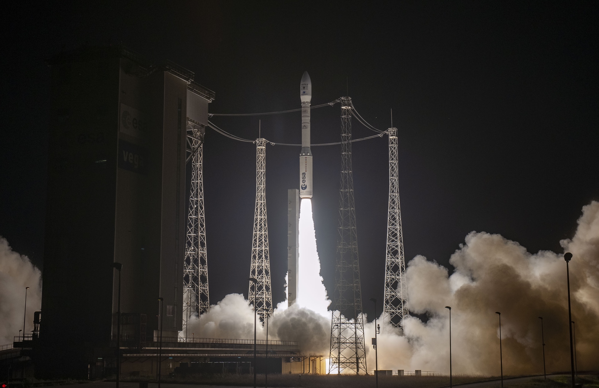
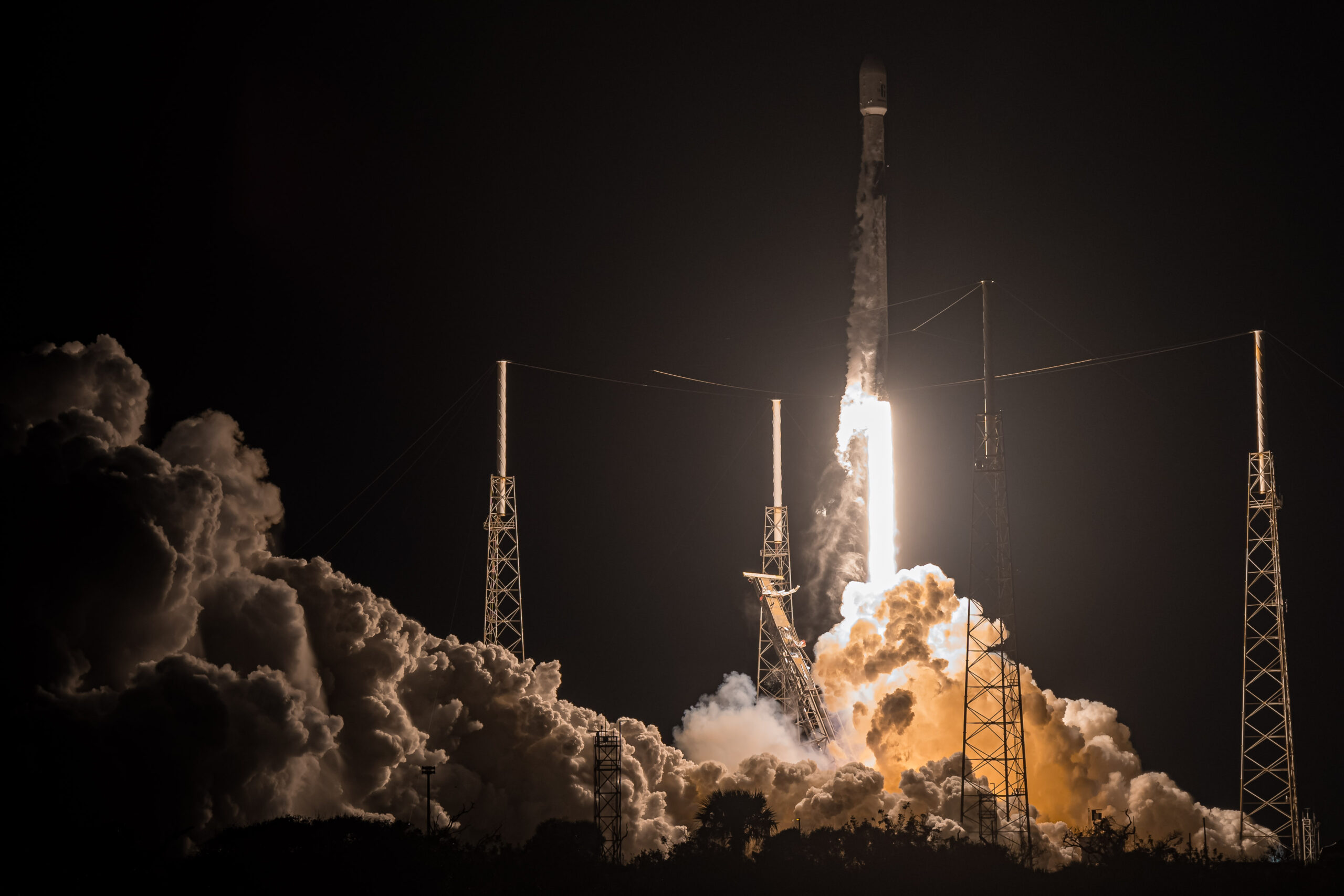
WASHINGTON — A Vega rocket successfully launched a dozen small satellites Oct. 8 while its more powerful version remains grounded for another year.

The Vega rocket lifted off from the European spaceport at Kourou, French Guiana, at 9:36 p.m. Eastern. The launch was originally scheduled for Oct. 6 but scrubbed in the final minute of the countdown. Arianespace said the delay was due to “a measurement slightly above its maximum threshold” but did not elaborate. The company rescheduled the launch to Oct. 7 but pushed it back an additional day to complete checks on the vehicle.

The two largest payloads on the launch were THEOS-2 and FORMOSAT-7R/TRITON, both placed in sun-synchronous orbits between 600 and 617 kilometers nearly 55 minutes after liftoff.

The 417-kilogram THEOS-2 was built by Airbus Defence and Space for Thailand’s Geo-Informatics and Space Technology Development Agency. It will provide imagery at resolutions of up to 0.5 meters, providing service continuity for the 15-year-old THEOS-1, also built by Airbus.

FORMOSAT-7R/TRITON was built and will be operated by the Taiwan Space Agency. The 241-kilogram satellite will collect radio occultation data from navigation satellites for use in weather forecasting.

The Vega carried 10 secondary payloads, cubesats ranging in size from 3U to 12U. The satellites come from a variety of European developers, including those supported by the European Space Agency and European Union, primarily for technology demonstration purposes. Those satellites were released 1 hour and 44 minutes after liftoff, although Arianespace said in an Oct. 9 statement that it was still awaiting confirmation of the deployment of two of the cubesats.

The launch, designated VV23 by Arianespace, was the first for the Vega family of vehicles since the December 2022 failure of the more powerful Vega C on its second launch. That failure was blamed on the Zefiro 40 motor used as the second stage of the Vega C. The original Vega, flown on this launch, uses the smaller Zefiro 23 motor as its second stage.

The Vega C remains grounded after an anomaly during a static-fire test of the upgraded Zefiro 40 motor in June. The investigation into that incident found problems with the design of the motor’s nozzle after its carbon-carbon throat insert was replaced to address the cause of the December launch failure.

ESA said Oct. 2 that the return to flight of the Vega C, previously projected to take place before the end of this year, has been pushed out to the fourth quarter of 2024 to given engineers time to make changes in the motor and conduct two static-fire tests.

Arianespace said a final launch of the original version of Vega is planned for the second quarter of 2024. The customer for that launch, as well as the return to flight of Vega C, has not been announced.

source

Russian ISS module experiences coolant leak

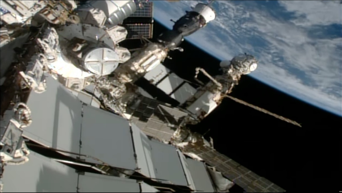
WASHINGTON — A radiator on the Russian segment of the International Space Station started leaking coolant Oct. 9, the third such incident involving Russian hardware at the station in less than a year.

NASA said in a statement that flight controllers noticed flakes coming from one of two radiators on the Nauka module on the station’s Russian segment at around 1 p.m. Eastern. That module, also known as the Multipurpose Laboratory Module (MLM), was installed on the station in July 2021.

Flight controllers informed the station’s crew, who were able to visually confirm the leak. “Yeah, there’s a leak coming from the radiator on MLM,” NASA astronaut Jasmin Moghbeli told controllers in audio streamed by NASA online.

It was unclear how much coolant leaked from the radiator and for how long. In its statement, NASA said that Roscosmos informed the agency that the leak was with a backup radiator on Nauka. That radiator was originally on the Rassvet module, launched to the station in 2010, and transferred to Nauka earlier this year as part of a series of spacewalks to outfit Nauka.

In a statement posted to social media, Roscosmos said that the main thermal control system on Nauka is working properly, and that neither station nor its crew are in danger. NASA offered a similar assessment, saying there were “no impacts to the crew or to space station operations.” The station’s crew, though, did close shutters on windows on the U.S. segment of the station to prevent contamination from the leaking coolant.

The incident is the third time in less than a year that a Russian vehicle at the ISS has suffered a coolant leak. In December, the Soyuz MS-22 spacecraft lost coolant three months after arriving at the station. That led Roscosmos to replace that spacecraft with an uncrewed Soyuz spacecraft, Soyuz MS-23, a decision that kept the crew that launched to the station on Soyuz MS-22 in space for an extra six months, returning Sept. 27.

In February, an uncrewed Progress MS-21 cargo spacecraft also experienced a coolant leak. That leak took place just before the spacecraft, which launched the previous October, was scheduled to undock from the station.

The two leaks raised suspicions of a design or manufacturing flaw with the spacecraft. However, Roscosmos concluded that the leaks were caused by impacts with micrometeoroids or orbital debris. NASA officials accepted that conclusion.

“The NASA team has also looked at it, independent of the Russian team, and we also cannot find anything, based on the information we’ve been given by our Russian colleagues, of anything other than some type of external force or debris or something else like that,” said Joel Montalbano, NASA ISS program manager, at a July briefing.

It was unclear if the leak will affect plans for a pair of spacewalks from the U.S. segment. NASA astronaut Loral O’Hara and ESA astronaut Andreas Mogensen are scheduled to perform one spacewalk Oct. 12 to perform station maintenance and collect science samples while O’Hara and Moghbeli will perform another Oct. 20 to conduct additional station maintenance.

source

Ancient leaf wax holds clues to future climate

Researchers have used chemicals from preserved plant matter to pinpoint the processes responsible for changes in past rainfall and drought in southwestern Africa.

Their findings, published in Geophysical Research Letters, may have implications for the future.

In September 2023, extreme rains struck South Africa’s Western Cape province, flooding villages and leaving a trail of destruction. The catastrophic devastation is just one recent example in a string of extreme weather events that are growing more common around the world. Fueled by rising sea surface temperatures from global warming, torrential storms are increasing both in frequency and magnitude. Concurrently, global warming is also producing the opposite effect in other instances, such as mega-drought that recently threatened the water supply of Cape Town in southwestern Africa to the point where residents were at risk of running out of water. This one-two punch of weather extremes is devastating habitats, ecosystems, and human infrastructure.

In the study led by Claire Rubbelke, a PhD candidate in earth and environmental sciences at Syracuse University, and Tripti Bhattacharya, professor of earth and environmental sciences, researchers zeroed in on the Pliocene epoch (~3 million years ago)—a time when conditions were very similar to today’s. Despite warmer temperatures, many parts of the world, including southwestern Africa, experienced dramatic increases in rainfall over land, likely caused by warmer than normal sea surface temperatures. This mimics a modern event called a Benguela Niño, where researchers believe shifting winds cause warm waters to move southward along the coast of Africa causing enhanced rainfall over typically arid regions.

“In the present day, the intensity and location of extreme precipitation from Benguela Niño events appear to be influenced by both Atlantic and Indian Ocean sea surface temperatures,” says Rubbelke, who is a member of Bhattacharya’s Paleoclimate Dynamics Lab. “During the Pliocene, it appears that these Benguela Niño-like conditions may have been a permanent feature.”

The team’s work was inspired by collaborator and study coauthor Natalie Burls, associate professor at George Mason University. Burls, an oceanographer and climate scientist from South Africa who received a PhD at the University of Cape Town, has long been intrigued by the way geological evidence from past warm climates in Earth’s history can help researchers make sense of future rainfall and drought conditions.

“This study, which explored how past warm climates can inform us on what to expect in the future as our planet warms, brings to the fore the important role of ocean warming patterns,” says Burls. “It’s important to understand how these patterns determine the response of the hydrological cycle over southwest Africa to global warming.”

To study the impact of global warming on precipitation from millions of years in the past, the team analyzed “molecular fossils” in the form of ancient leaf waxes. “These are compounds produced by leaves to protect themselves from drying out,” says Bhattacharya. “They get shed from leaf surfaces and find their way to ocean sediments, where we can extract them and study their chemical composition.”

Plants use hydrogen from rainwater to produce the waxy outer coating on their leaves, which survives in ocean sediment for millions of years. The leaf wax functions as a time capsule preserved in ocean sediment.

After transporting the millions-year-old sediment from Africa to their lab in Syracuse, Rubbelke and Bhattacharya used heat and pressure to extract lipids (e.g. fat molecules), and then used a variety of solvents to isolate the exact class of molecules that they were looking to measure. From those molecules, they determined the number of different types of hydrogen present.

“When we measure the amount of heavy and light isotopes of hydrogen in the waxes, it reveals different physical processes like increased rainfall, or how far the water vapor travels,” says Rubbelke. “We can therefore identify changes in these processes by looking at long-term changes of hydrogen.”

By comparing their data to climate models, they verify how well those models capture past climate change, which can in turn improve the accuracy of those models to predict future rainfall. As Bhattacharya notes, this is critical because climate models often disagree on whether certain regions will get wetter or drier in response to global warming.

“We are using real world data from the ancient geologic past to improve our ability to model rainfall changes as the planet warms,” she says.

The study’s third author, Ran Feng, assistant professor of earth sciences at the University of Connecticut, helped analyze the comparison data and specifically examined the proposed mechanism that explains the Pliocene wet conditions in southwest Africa. She says many features of ongoing climate change are reincarnations of the past warm climates.

“In our case, we have shown that sea surface temperature pattern surrounding South Africa is key to explaining the past hydroclimate conditions of this region,” notes Feng. “Looking into the future, how this sea surface temperature pattern may evolve has profound implications to the environmental changes in South Africa.”

Rubbelke, whose interest in paleoclimate research started in high school while studying ice cores and oxygen isotopes, says that the work she is doing alongside Bhattacharya at Syracuse is particularly fulfilling because they are contributing valuable data to an area where there is currently a knowledge gap.

“This research is really cool because not a lot of paleoclimate records from the Southern Hemisphere exist, compared to the Northern Hemisphere at least,” says Rubbelke. “I feel like I’m really contributing to an international research effort to rectify that.”

As to whether the future will be wetter or drier in southwestern Africa, the team’s results suggests that both are possible, depending on where extreme sea surface temperatures are occurring.

While not much can be done to reverse global warming, short of cutting the use of fossil fuels completely, the researchers say this study illuminates the need for vulnerable communities to have the tools and resources to adapt to these seemingly more frequent extreme weather events.

“A key aspect of helping vulnerable communities involves improving our ability to predict hydroclimate extremes, “says Bhattacharya. “Our study directly speaks to this need, as we show that sea surface temperature patterns strongly influence climate models’ ability to predict changes in rainfall in southwestern Africa.”

Bhattacharya and Rubbelke’s research on this project had support from the National Science Foundation.

Source: Syracuse University

source

Virgin Galactic performs fourth commercial suborbital flight

WASHINGTON — Virgin Galactic continued its monthly cadence of commercial suborbital spaceflights Oct. 6, carrying three customers that included the first person from Pakistan to go to space.

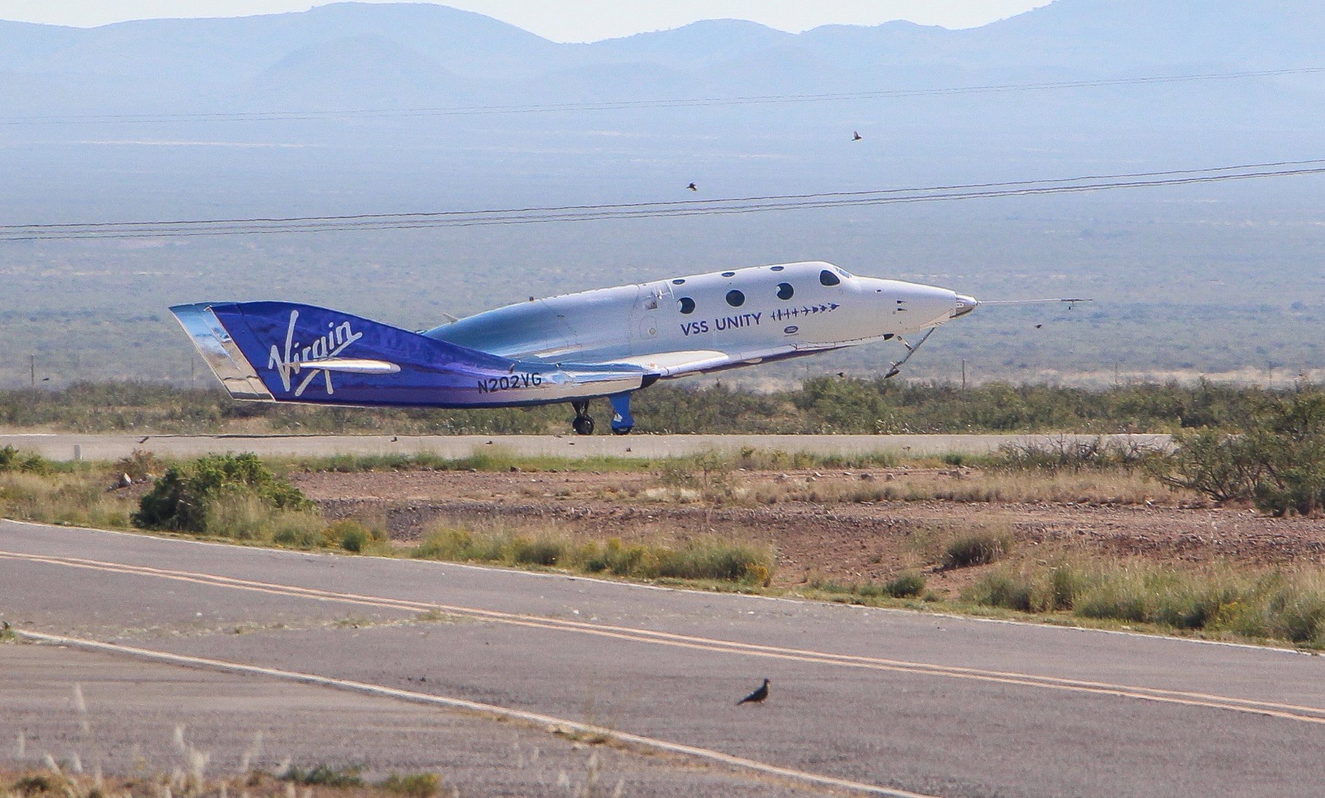
Virgin Galactic’s SpaceShipTwo vehicle, VSS Unity, took off from Spaceport America attached to its VMS Eve mothership at 11:28 a.m. Eastern. VSS Unity released from the plane at 12:10 p.m. Eastern, flying to an apogee of 87.5 kilometers before gliding back to a runway landing at the spaceport.

As with the previous flight, Galactic 03 on Sept. 8, Virgin Galactic did not provide a live broadcast, limiting itself to social media updates. Those updates themselves were published on a time delay: one post announcing ignition of the vehicle’s hybrid rocket motor was published at least 12 minutes after ignition, based on the timestamps in the images included with the post.

On board VSS Unity were three customers: Ron Rosano, Treavor Beattie and Namira Salim. The company did not release the customers’ names in advance of the flight, but all three disclosed their participation in the days leading up to the flight.

Rosano is an American who is involved in space education and also works for a property management company. Beattie is a British advertising executive and film producer who, according to a Virgin Galactic biography, accompanied company founder Richard Branson to a SpaceShipOne flight in 2004 and signed up for a Virgin Galactic flight “on the spot.” Salim, an adventurer and entrepreneur, is the first person from Pakistan to go to space, although she now lives in Monaco and Dubai.

VSS Unity was commanded by Kelly Latimer and piloted by CJ Sturckow. Beth Moses, the company’s chief astronaut instructor, also flew in the cabin with the customers, as on Virgin’s previous commercial flights.

The flight was the fourth for VSS Unity since the company started commercial service in late June. The company said it planned to maintain a monthly flight cadence for the foreseeable future, slowly working through its backlog of about 800 customers, some of whom paid deposits for their tickets more than 15 years ago.

“Our teams in New Mexico and California have delivered on our monthly spaceflight objectives,” Michael Colglazier, chief executive of Virgin Galactic, said in a statement after the flight. That statement added the company would turn VSS Unity around for its next flight, Galactic 05, but did not disclose a projected date for it.


source

Libyan floods show climate change’s threat to infrastructure

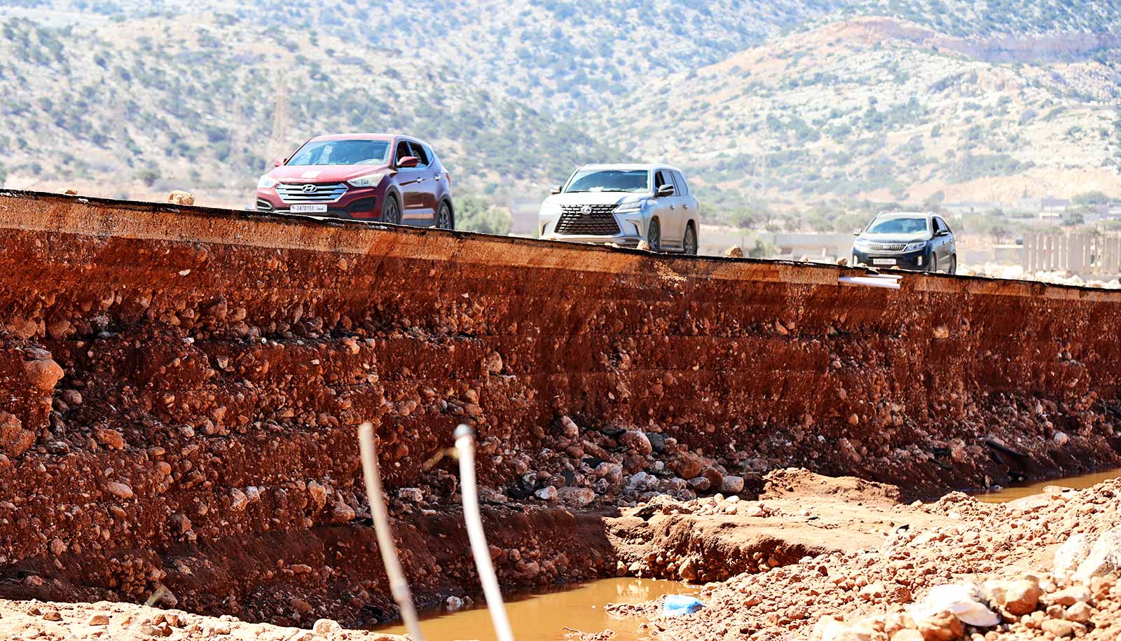
In the aftermath of the collapse of two dams in the Libyan coastal city of Derna, where floodwaters spawned by a powerful storm killed thousands of people, experts in engineering, environmental science, and other fields warn that global infrastructure must be adapted to deal with the climate crisis.

With a seasonal river running through it from the highlands to the south, Libya’s coastal city of Derna always had been vulnerable to flooding.

So, when engineers from the former Yugoslavia built a pair of dams near Derna in the 1970s, residents welcomed the project as a blessing—the protection they so badly needed from dangerous floodwaters that had devastated their lands in years past.

But now, the Mediterranean city of 90,000 is burying its dead after record-breaking rainfall from powerful Storm Daniel produced floodwaters that likely overwhelmed the two dams and led to their collapse.

After the dams failed, a wall of water several stories high ripped through the city, crashing into buildings, washing entire neighborhoods out to sea, and drowning thousands of people. More than 11,000 have died, according to the Libyan Red Crescent, and thousands more are missing. Officials fear the death count could reach 20,000.

In the aftermath of the latest blow to a country that has been mired in conflict and chaos for years, reports have surfaced that the two aging, clay-core embankment dams had not been properly maintained, making it likely they would collapse under intense pressure.

“Right now, that’s the big question—whether the dams were maintained,” says Jean Pierre Bardet, a professor of civil and architectural engineering for the University of Miami College of Engineering. “Dams are supposed to be maintained. It’s like a car—you can have a good design, but if you don’t maintain it, you are going to weaken it. In this case, many people are quick to say the dams were not maintained, but we need to be more patient and not jump too fast until we have more information.”

But whatever the cause of their failure, one thing is clear: From bridges and roads to dams and power plants, extreme weather fueled by climate change poses a serious threat to global infrastructure. This makes it critical for communities to adapt and become more resilient, experts agree.

“[The disaster in Libya] is in part a story about torrential rains dropping historical amounts of water. But it is, like nearly every climate resilience story, also one of a stressed community not having the capacity to account for new climate realities,” says Michael Berkowitz, executive director of the university’s Climate Resilience Academy and the chair in climate resilience.

Before it reached Libya, Storm Daniel transformed into what’s called a “medicane,” a tropical-like cyclone that occasionally forms over the Mediterranean Sea. “They were first formally observed about 40 years ago, but there have been over 100 of them just in the past 70 years or so,” says Brian McNoldy, a tropical cyclone expert and senior research associate at the Rosenstiel School of Marine, Atmospheric, and Earth Science. “They reach peak intensities of Category 1-2 hurricane equivalent, and they’re infamous for producing devastating flooding because most of the surrounding areas are rather dry.”

Climate change, according to some scientists, will produce more extreme events like Storm Daniel. And as it does, it “will test our historically based design standards,” Berkowitz says. “All communities around the world should be reexamining the design of their critical infrastructure with new and evolving climate projections in mind.”

As climate change intensifies, the importance of climate-proofing both new and existing infrastructure becomes even more critical to maintaining safety, says Katharine Mach, a professor of environmental science and policy at the Rosenstiel School. But while it is easier to integrate climate change mitigation and adaptation measures into new infrastructure, it is more difficult to adjust and adapt existing structures and facilities, she points out.

“Globally, we’ve seen some powerful examples of plans to make sure infrastructure can continue its functioning under continuing climate change,” says Mach, noting the Thames Barrier, the retractable barrier system constructed to protect the floodplain of most of London from high tides and storm surges.

“International development support has been an arena that made early breakthroughs in standards for climate proofing infrastructure investments,” Mach says. “For example, the World Bank innovated approaches to mainstreaming consideration of climate resilience for new projects. These efforts are critical.”

Existing infrastructure must not only be adapted, but also routinely inspected for wear and tear as it ages, stressed Esber Andiroglu, associate professor of practice in the College of Engineering’s civil and architectural engineering department.

“In most developed nations, regulatory agencies typically offer and require routine inspection and evaluation for such structures to ensure public safety and preservation of economic resources invested in such structures,” Andiroglu says. And when defects in infrastructure are found, those agencies implement repairs, he adds.

“Unfortunately, such guidelines and practices are not always in place in other regions across the globe,” he continues. “Libya falls into this category, with much of its built environment having been left unattended since its original construction.”

War and the absence of a central government left Libya with a compromised infrastructure, according to Shouraseni Sen Roy, a professor of geography and sustainable development, who specializes in climate change and geospatial analysis. “It’s a combination of an unstable political environment, crumbling infrastructure, and under preparedness that contributed to this massive disaster,” she says.

More countries, Andiroglu says, need to adopt and adhere to building and construction codes established by the International Code Council, a US-based membership association dedicated to developing model codes and standards in the design, build, and compliance process.

“The increasing frequency of extreme climate events,” he explains, “necessitates more frequent evaluation and retrofit of structures.”

Source: University of Miami

source

Heat-resistant membrane separates molecules for less

A new heat-resistant membrane could make separating molecules less costly.

Industry has long relied upon energy-intensive processes, such as distillation and crystallization, to separate molecules that ultimately serve as ingredients in medicine, chemicals, and other products.

In recent decades, there has been a push to supplant these processes with membranes, which are potentially a lower-cost and eco-friendly alternative. Unfortunately, most membranes are made from polymers that degrade during use, making them impractical.

To solve this problem, a University at Buffalo-led research team has created the new, sturdier membrane that can withstand harsh environments—high temperatures, high pressure, and complex chemical solvents—associated with industrial separation processes.

Made from an inorganic material called carbon-doped metal oxide, it appears in a study in the journal Science.

“The processes of separating molecules—whether for water desalination, the production of medicine or fertilizers—use an incredible amount of energy,” says the study’s corresponding author, Miao Yu, professor in the department of chemical and biological engineering in the University at Buffalo School of Engineering and Applied Sciences.

“What we have developed is a technique to easily fabricate defect-free, strong membranes that have rigid nanopores that can be precisely controlled to allow different-sized molecules to pass through,” adds Yu, a core faculty member in the UB RENEW Institute.

To create the membrane, the research team took inspiration from two common, but unrelated, manufacturing techniques.

The first is molecular layer deposition, which involves layering thin films of materials and is most often associated with semiconductor production. The second technique is interfacial polymerization, which is a method of combining chemicals that is commonly used to create fuel cells, chemical sensors, and other electronics.

“These methods are not new,” says Sengupta, “however the manner in which we apply them is, and that is the key to creating our new nanoporous membranes.”

In experiments, researchers merged two low-cost reactants—liquid ethylene glycol and gaseous titanium tetrachloride—on an aluminum-based support. Within minutes, the reaction created a thin-film.

To create the nanopores, they applied heat to the film. The heat burns off carbon, creating tiny, microscopic holes for molecules to pass through. The size of the nanopores can be anywhere from 0.6 to 1.2 nanometers in diameter—as determined by the calcination gas environment, as well as the amount and duration of heat.

The new membrane can withstand temperatures up to 284 F (140 C) and pressures up to 30 atmospheres when exposed to organic solvents. These attributes are key because they allow the membrane to separate molecules at high temperatures (for most polymer membranes to work, the temperature of the solvents must be lowered, which is costly from an energy standpoint).

“From this point of view, our membrane has the potential reduce the carbon footprint of many industrial processes,” Yu says.

To demonstrate the membrane’s effectiveness, the team showed it could separate boscalid, a fungicide used to protect crops, from its catalyst and starting reagent. The entire process occurred at 194 F.

The team is planning additional experiments to prove the membrane is capable of being scaled up for commercial products. Additionally, Yu plans to start a company to further the technology’s commercial viability.

Additional coauthors come from the department of mechanical and aerospace engineering in the University at Buffalo School of Engineering and Applied Sciences, and Rensselaer Polytechnic Institute.

The work had support from the National Science Foundation, the Department of Energy, and the university.

Source: University at Buffalo

source

Space weather messes up night-time bird migration

Space weather disrupts nocturnal bird migration, a new study finds.

It’s well-known that birds and other animals rely on Earth’s magnetic field for long-distance navigation during seasonal migrations.

But how do periodic disruptions of the planet’s magnetic field, caused by solar flares and other energetic outbursts, affect the reliability of those biological navigation systems?

Researchers used massive, long-term datasets from networks of US Doppler weather radar stations and ground-based magnetometers—devices that measure the intensity of local magnetic fields—to test for a possible link between geomagnetic disturbances and disruptions to nocturnal bird migration.

They found a 9%-17% reduction in the number of migrating birds, in both spring and fall, during severe space weather events. And the birds that chose to migrate during such events seemed to experience more difficulty navigating, especially under overcast conditions in autumn.

The new findings, published in the Proceedings of the National Academy of Sciences, provide correlational evidence for previously unknown relationships between nocturnal bird migration dynamics and geomagnetic disturbances, the researchers say.

“Our findings highlight how animal decisions are dependent on environmental conditions—including those that we as humans cannot perceive, such as geomagnetic disturbances—and that these behaviors influence population-level patterns of animal movement,” says lead author Eric Gulson-Castillo, a doctoral student in the University of Michigan ecology and evolutionary biology department.

Earth’s magnetic field is regularly affected by solar outbursts that can trigger colorful auroras and that sometimes disrupt satellite communications, human navigation systems, and power grids.

But little is known about how those disturbances affect animals that depend on Earth’s magnetic field for migratory orientation and navigation. Previous experimental studies over several decades provide strong evidence that birds, sea turtles, and other organisms key into small changes in magnetic inclination, intensity, and declination when making orientation decisions and developing navigational maps.

One recent study examined millions of bird banding records and found that geomagnetic disturbances were associated with increased incidence of migratory bird “vagrancy,” that is, birds becoming lost during migration.

But most previous studies were narrowly focused in geographic extent, duration, and the number of species examined. The newly published study, in contrast, uses a 23-year dataset of bird migration across the US Great Plains to provide new insights at population and landscape levels.

The researchers used images collected at 37 NEXRAD radar stations in the central flyway of the US Great Plains, a major migratory corridor. The flyway spans more than 1,000 miles in the US, from Texas to North Dakota.

The research team selected this relatively flat region to minimize influences from mountainous topography or oceanic and Great Lakes coastlines. Their final datasets included 1.7 million radar scans from the fall and 1.4 million from the spring.

The community of nocturnally migrating birds in this region is primarily composed of a diverse set of perching birds (Passeriformes, 73% of species) such as thrushes and warblers; shorebirds (Charadriiformes, 12%) such as sandpipers and plovers; and waterfowl (Anseriformes, 9%) such as ducks, geese, and swans.

The NEXRAD radar scans detect groups of hundreds to thousands of migrating birds. Migration intensity—meaning the number of birds in each cluster—can be estimated and direction of flight can be measured.

Concurrent geomagnetic measurements were accessed through superMAG, a worldwide collection of geomagnetic ground stations. Data were collected from magnetometer stations near weather radar sites.

The researchers matched data from each radar station with a customized, spatiotemporally explicit index of geomagnetic disturbance that represents the maximum hourly change from background magnetic conditions.

Daniel Welling, assistant professor in the climate and space sciences and engineering department at the University of Michigan and Michelle Bui, a former University of Texas at Arlington undergraduate, compiled the space weather data and designed the geomagnetic disturbance index. Welling and Bui are coauthors of the new study.

“The biggest challenge was trying to distill such a large dataset—years and years of ground magnetic field observations—into a geomagnetic disturbance index for each radar site,” Welling says. “There was a lot of heavy lifting in terms of assessing data quality and validating our final data product to ensure that it was appropriate for this study.”

The data trove was fed into two complementary statistical models to measure the putative effects of magnetic disturbances on bird migration. The models controlled for the known effects of weather, temporal variables such as time of night, and geographic variables such as longitude and latitude.

“We found broad support that migration intensity decreases under high geomagnetic disturbance,” says senior author Ben Winger, assistant professor in the ecology and evolutionary biology department and a curator of birds at the University of Michigan Museum of Zoology.

“Our results provide ecological context for decades of research on the mechanisms of animal magnetoreception by demonstrating community-wide impacts of space weather on migration dynamics.”

The researchers also found that migrating birds appear to drift with the wind more frequently during geomagnetic disturbances in the fall, instead of expending great effort to battle crosswinds.

“Effort flying” against the wind was reduced by 25% under cloudy skies during strong solar storms in the fall, suggesting that a combination of obscured celestial cues and magnetic disruption may hinder navigation.

“Our results suggest that fewer birds migrate during strong geomagnetic disturbances and that migrating birds may experience more difficulty navigating, especially under overcast conditions in autumn,” says Gulson-Castillo, who conducted the study as part of his doctoral dissertation. “As a result, they may spend less effort actively navigating in flight and consequently fly in greater alignment with the wind.”

Additional coauthors are from Cornell University, Colorado State University, and the University of Michigan.

The National Science Foundation supported the work.

Source: University of Michigan

source

Connecting the Dots | Double whammy for space insurance

An issue with the Inmarsat-6 (I6) F6 2 satellite could send the space insurance market deep into the red, pushing up rates that were already rising following news of ViaSat-3’s troubles just six weeks earlier.

While engineers are still working on salvaging at least some of the broadband capacity on ViaSat-3, insurers are bracing for a $420 million total loss. That would be nearly 80% of the $550 million premium income the market at one point expected for 2023, according to insurers who did not want to be named.

Meanwhile, insurers say a total I-6 F6 2 loss would set the market back $350 million.

Not much has been disclosed about the anomalies ViaSat-3 and I-6 F6 2 experienced after successfully launching toward geostationary orbit in April and February, respectively.

Boeing-built ViaSat-3 suffered an antenna deployment failure, and I-6 F6 2, built by Airbus Defense and Space, has an issue with its power subsystem. California-based Viasat was to operate both satellites for its multi-band connectivity constellation.

Viasat said Aug. 24 it was assessing whether I-6 F6 2 could still perform its primary mission to provide mobile connectivity services across maritime, aviation, and government markets.

The size of these two potential insurance claims easily eclipses other insured satellite failures so far this year.

Arcturus, the first satellite from startup Astranis that shared a Falcon Heavy rocket with ViaSat-3, suffered a separate issue with its solar arrays, likely resulting in a $40 million claim.

And the payout for Azersky/Spot-7, Azerbaijan’s first Earth observation satellite that failed nine years after launching into orbit, is only around $25 million.

That means the space insurance market is potentially looking at $835 million in total claims for 2023, with four months remaining.

The anticipated $550 million in premium income for 2023 also includes coverage for a second ViaSat-3 satellite that was secured ahead of its launch, which was planned for this year but could be delayed to allow for any design changes.

Rates hike

News in July of a potentially mammoth insurance claim for ViaSat-3 was already enough for some insurers to increase rates.

Despite having climbed following a string of launch failures around four years ago, rates are still at historically low levels — usually in low single digits as a percent of payload value, which some insurers see as unsustainable.

Richard Parker, co-head of space at underwriter Canopius, said his firm raised prices across the board after the Viasat-3 announcement.

“It’s not huge, but it’s meaningful,” Parker told SpaceNews shortly before news of I-6 F6 2’s issues hit the market, “and we’ve been carrying on. We’ve been writing business on that basis with higher rates.”

Space insurance is typically syndicated to a market with only around 30 underwriters specializing in the industry, so others were likely also raising prices.

“If I put my price up and no one else did, I just wouldn’t get any business,” Parker said.

Parker declined to specify sums insured but said news of I-6 F6 2’s issues “came like an earthquake,” adding that there have not been two potentially massive insured losses so close together for at least 20 years.

Higher prices might not be enough to keep some space underwriters in the game.

Operators “are not going to pay 20% insurance rates,” Parker said, “so I don’t know where we’re going at this point.”

According to data from underwriter AXA XL, the average net rate for launch +1 coverage has fallen from more than 20% roughly two decades ago to around 1.6% for 2022. The average annual net in-orbit rate has declined from just under 15% to 1% during this time.

Less competition among a shorter pool of underwriters would also drive rates higher while potentially lacking the capacity to cover sizable risks.

There are two main types of satellite insurance: Coverage for the launch plus one year of a satellite’s operations and in-orbit coverage that usually starts on the first anniversary of that launch and is renewed annually.

“Launch plus one” coverage is usually taken out two years or so before lift-off. Operators are currently holding off tapping the market for this coverage in the hope price volatility will settle down.

AST SpaceMobile chief strategy officer Scott Wisniewski said he had no concerns about accessing the market for future launches in an Aug. 18 email, even as its first five commercial satellites are due to fly in the first quarter of 2024.

However, on-orbit coverage can’t wait, and it’s here that operators face higher-than-expected rates in the near term as their policies come up for renewal.

While any savvy operator would leave room in their cost models to cater to price volatility, even small cost bumps are unwelcome during challenging economic conditions. Lenders also usually require operators to insure their spacecraft.


This article originally appeared in the September 2023 issue of SpaceNews magazine.

source