Pakistan becomes latest country to join China’s ILRS moon project

HELSINKI — Pakistan officially joined China’s International Lunar Research Station, the China National Space Administration announced Friday.

Zhang Kejian, CNSA administrator, and Moin ul Haque, the ambassador of Pakistan to China, signed an understanding between China National Space Administration and the Pakistan Space and Upper Atmosphere Research Commission (SUPARCO) Oct. 18 on cooperation on the International Lunar Research Station (ILRS), according to the CNSA statement Oct. 20. 

The signing was witnessed by Chinese Premier Li Qiang and Pakistans’s interim prime minister, Anwaar ul Haq Kakar. The agreement will see CNSA and SUPARCO carry out extensive cooperation in the demonstration, implementation, operation and application of the ILRS, as well as training and other areas, according to the statement.

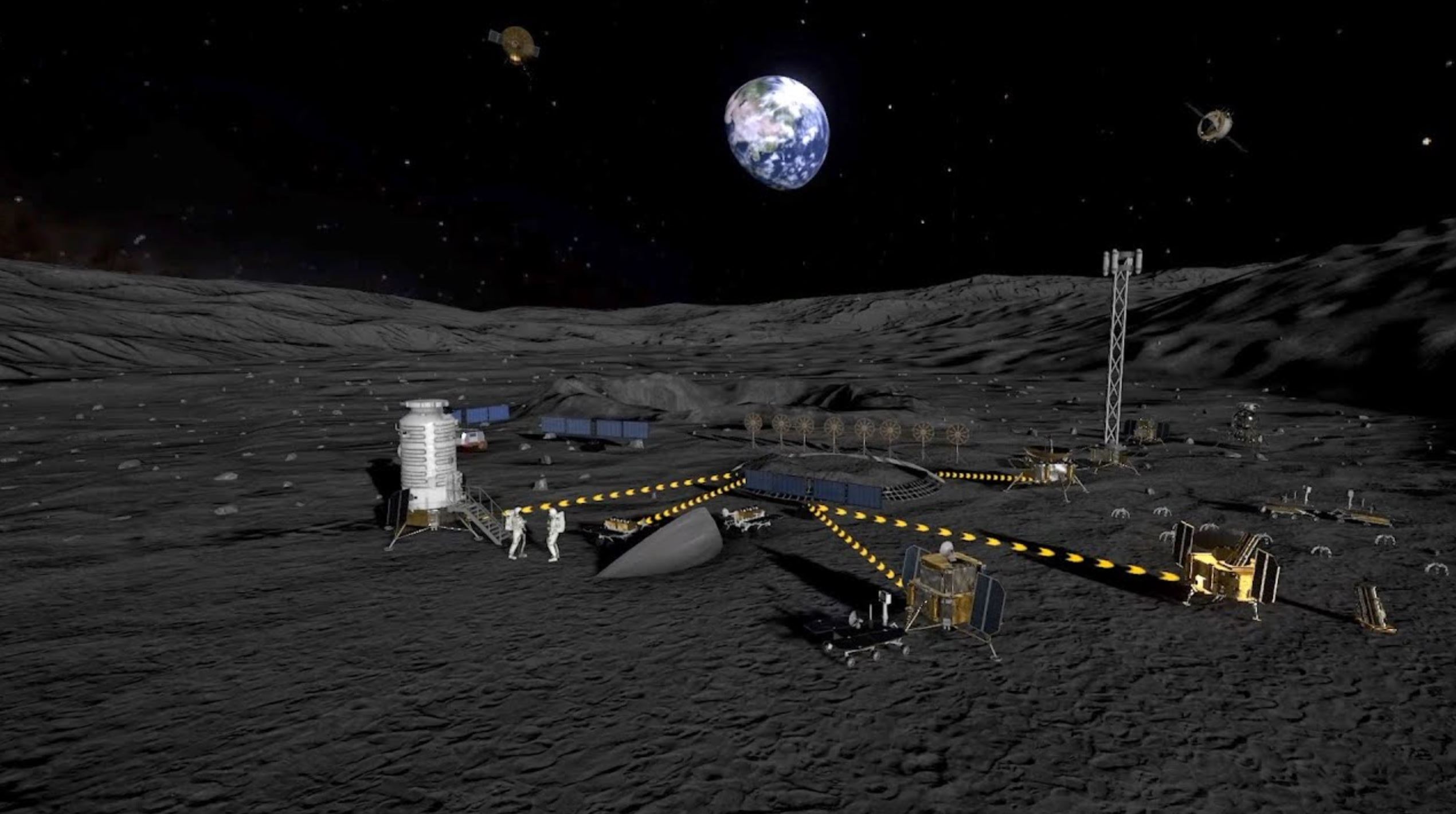
The China-led ILRS project aims to construct a permanent lunar base in the 2030s, with precursor missions in the 2020s. The initiative is seen as a China-led, parallel project and potential competitor to the NASA-led Artemis Program.

The announcement marks Pakistan’s formal participation in the International Lunar Research Station program. It follows the announcement Oct. 8 that Azerbaijan had joined the project.

CNSA and SUPARCO also signed a Memorandum of Understanding on cooperation on space debris and space traffic management.

Pakistan is already involved in the Chang’e-6 lunar sample return mission, due to launch in mid-2024. It is working on the ICUBE-Q cubesat for the mission in cooperation with Shanghai Jiaotong University.

Pakistan has a handful of satellites in orbit, including the Pakistan Remote Sensing Satellite-1 (PRSS-1) built and launched by China in 2018. The experimental, SUPARCO-made PakTES-1A was also aboard the Long March 2C flight. CNSA and SUPARCO have previously been reported to be working towards signing a framework agreement on human spaceflight cooperation.

Russia, Venezuela and South Africa are the other known national or space agency-level signatories. The Asia-Pacific Space Cooperation Organization (APSCO), Swiss firm nanoSPACE AG, the Hawaii-based International Lunar Observatory Association (ILOA), and the National Astronomical Research Institute of Thailand (NARIT) have also signed joint statements. 

China and Russia presented a joint road map for the ILRS in St. Petersburg in June 2021. Beijing has however since apparently taken the role of lead of the project since Russia’s invasion of Ukraine. A Chinese official at the 74th International Astronautical Congress (IAC) in Baku, Azerbaijan, earlier this month presented ILRS mission slides showing only Chinese Long March 9 rockets involved in launching infrastructure. The new slide omits the Russian super heavy-launch vehicles displayed in the 2021 roadmap.

China is setting up an organization, named ILRSCO, in the city of Hefei in Anhui province to coordinate the initiative. 

The Deep Space Exploration Laboratory (DSEL), under CNSA, stated earlier this year that China aims to complete the signing of agreements with space agencies and organizations for founding members of ILRSCO by October.

ILRS signatory Type
China Country
Pakistan Country
Azerbaijan Country
Russia Country
Venezuela Country
South Africa Country
Asia-Pacific Space Cooperation Organization (APSCO) Inter-governmental Organization
nanoSPACE AG (Swiss firm) Firm
International Lunar Observatory Association (ILOA) Organization
National Astronomical Research Institute of Thailand (NARIT) Institute
A list of known official ILRS signatories as of Oct. 20, 2023. Credit: Andrew Jones/SpaceNews

The U.S. and China are separately and competitively working on respective robotic and crewed lunar plans as part of a renewed interest in the moon and separate efforts to assert leadership in space exploration. The rivalry is also illustrative of a possible development of discrete international space industry ecosystems and plans.

The U.S. is growing the number of signatories to its Artemis Accords, the political underpinning of the Artemis lunar program. Last month Germany became the 29th country to sign up.

NASA plans to launch its Artemis 2 crewed circumlunar mission in November 2024. It will be followed by Artemis 3, a crewed lunar landing at the lunar south pole, no earlier than late 2025.

China has announced a plan to put a pair of astronauts on the moon before 2030. It will launch the Chang’e-7 and Chang’e-8 ILRS precursor missions in 2026 and 2028 to verify necessary technologies for the ILRS.

source

Japanese government grant to support work on new ispace lunar lander

LAS VEGAS — The Japanese government is providing ispace with $80 million to help fund development of a new lunar lander in parallel with a similar effort by the company’s U.S. subsidiary.

Tokyo-based ispace said Oct. 20 that it won an innovation grant from the government’s Ministry of Economy, Trade and Industry (METI) worth up to 12 billion yen ($80 million) for work on what the company calls the Series 3 lunar lander that will be ready for launch by 2027.

The award, a Small Business Innovation Research (SBIR) grant similar to those awarded by U.S. government agencies but on a much larger scale, is part of an effort by the Japanese government to fund work on innovative research and development, the company said in a statement.

The lander will be designed to carry at least 100 kilograms of payload to the lunar surface, said Ryo Ujiie, chief technology officer of ispace, at an online briefing Oct. 23. That lander could eventually carry up to 500 kilograms as a “final target” for its design, he added.

He and other ispace executives offered few details about the design of the Series 3 lander or even an illustration of it. “The Series 3 lander is about to begin its development. The details are not decided yet,” he said.

It will, though, leverage work done on APEX 1.0, a lander formerly known as Series 2 that the company’s American subsidiary, ispace U.S., is separately developing. “If we can make any part of the development more efficient, we’ll do that. Also, there will be some parts that will be intentionally different between those two landers,” he said, but did not elaborate.

Takeshi Hakamada, chief executive of ispace, said the APEX 1.0 and Series 3 landers will serve different customers. APEX 1.0 “will be used to capture the requests and requirements by NASA,” he said, “and we have to meet the requirements by NASA,” such as use of U.S.-built components. APEX 1.0 is being used for a NASA Commercial Lunar Payload Services (CLPS) mission led by Draper.

While APEX 1.0 will be intended primarily for the U.S. market, he said there is “high demand” elsewhere for landers, prompting development of the Series 3 lander. “We are going to develop another lander to meet the demand from countries other than the States,” he said.

Executives declined to say how much it will cost the Series 3 lander but said it will be more than the value of the METI award. They said they are looking at options to finance the remaining cost of the lander, such as revenue from customer contracts.

The company has launched one lunar lander to date, the HAKUTO-R M1 mission that crashed attempting a landing in April. A second lander of the same design is scheduled to launch next year as Mission 2, with the first APEX 1.0 lander, for the Draper CLPS mission, is designated as Mission 3 by ispace and slated to launch in 2026.

The first Series 3 lander mission, part of the METI award, is scheduled for 2027 but will not necessarily be known as Mission 4, Hakamada said. “We are assuming Mission 6 for that, but that might change,” he said, declining to identify what ispace might fly as Mission 4 or 5.

source

Can ‘listening in’ on cells speed up disease diagnosis?

A new device employs an innovative method for “listening in” on cells’ conversations.

Scientists have long known that RNA (ribonucleic acid) acts as a messenger inside cells, translating DNA information to help cells make proteins.

But recently, scientists have discovered that certain types of RNA venture outside the cell wall. Each of these strands of “extracellular RNA,” or exRNA, rests inside a tiny carrier “bottle” and flows along bodily fluids like a microscopic message in a bottle, carrying information to other cells.

The new appreciation for exRNA also raised a tantalizing possibility: Could we use exRNA as a way of “listening in” on cells’ conversations?

“These extracellular RNAs are a goldmine of information,” says Hsueh-Chia Chang, professor of chemical and biomolecular engineering at the University of Notre Dame. “They can carry the early warning signs of cancer, heart disease, HIV, and other life-threatening conditions.”

Chang, an expert in nanofluidics, explains that diagnosing a disease using exRNA could prove not only more effective but also faster and cheaper than existing methods, since there is enough exRNA in a small sample of blood or another bodily fluid to signal the presence of many diseases.

But intercepting and interpreting exRNA messages has been a difficult challenge. Many labs have attempted to filter them from samples of blood or other bodily fluids. Many others have used advanced centrifuges to isolate exRNA.

These methods have met with little success for a simple reason: The different types of “bottles” that carry exRNA messages overlap in size and weight. Even the most advanced filters and centrifuges leave many carriers jumbled together. Labs using these methods have to add additional steps in which they add chemicals or small magnetic particles to further sort the carriers into discrete groups.

Four years ago, Chang and colleagues decided to try a radically new approach. In a study published in ACS Nano, the researchers describe the groundbreaking device that resulted from their research. The new technology uses a combination of pH (acidity/basicity) and electrical charge to separate the carriers. The idea relies on the fact that although the carriers overlap in size and weight, each type has a distinct “isoelectric point”—the pH, or level of acidity/basicity, at which it has no positive or negative charge.

The device integrates several existing technologies and fits neatly in the palm of the hand. Flowing through the middle of the device is what looks like a simple stream of water. But there is something special about the stream that is not visible to the naked eye. At the left side, the water is highly acidic, with a pH about the same as a glass of grapefruit juice. On the other side of the stream, the water is highly basic, with a pH similar to a bottle of ammonia.

A special feature of the device is not just the fact that it has a pH gradient in the stream but also how it achieves that gradient. The technology is able to generate the gradient without the addition of any chemicals, making it cheaper, more eco-friendly, and more efficient to run than designs that rely on added acids and bases.

The gradient comes not from a chemical but from a two-sided membrane powered by a specially designed chip. The membrane splits the water in two ions (H+ and OH-) and adds a different kind of ion to each side of the stream.

One side of the membrane releases acidic hydronium ions, and the other size releases basic hydroxide ions. When the basic and acidic streams flow together, they create a pH gradient just as hot and cold streams flowing together would form hot and cold sides with a gradient of temperature through the middle of the stream. The team used the two devices running in parallel to select the pH range required for carrier separation and optimized the process using machine learning.

The pH gradient achieved what filters and centrifuges could not: It caused the exRNA carriers floating in the stream to sort themselves like colors of light passing through a prism. The different types of carriers formed lines along their isoelectric points where they could easily flow out into separate outlets.

Thanks to the new method, the researchers were able to generate very pure samples (up to 97%t pure) using less than a milliliter of blood plasma, saliva, or urine. The process was also lightning-fast compared to current methods. Whereas the best existing technologies take about a day to achieve separation, the researchers were able to comprehensively sort their sample in just half an hour.

“We have filed for a patent and soon hope that the technology will be commercialized, so that it can help improve diagnoses of cancer and other diseases,” says Himani Sharma, a postdoctoral fellow who served as project lead.

“Noncommunicable diseases are responsible for more than 70% of deaths worldwide, and cardiovascular disease and cancer are responsible for most of that number,” Sharma says. “Our technology shows a path to improving the way clinicians diagnose these diseases, and that could save a tremendous number of lives.”

Source: University of Notre Dame

source

Stretchy liquid metal material could improve wearable tech

A super flexible, self-healing, and highly conductive material suitable for stretchy electronic circuitry could significantly improve the performance of wearable tech, soft robotics, smart devices, and more.

Imagine a stretchable and durable sensor patch for monitoring the rehabilitation of patients with elbow or knee injuries, or an unbreakable and reliable wearable device that measures a runner’s cardiac activities during training to prevent life-threatening injuries.

Disruptive innovations in wearable technology are often limited by the electronic circuits—which are usually made of conductive metals that are either stiff or prone to damage—that power these smart devices.

The newly engineered material, called the Bilayer Liquid-Solid Conductor (BiLiSC), can stretch up to a remarkable 22 times its original length without sustaining a significant drop in its electrical conductivity.

This electrical-mechano property, which has not been achieved before, enhances the comfort and effectiveness of the human-device interface, and opens up a wide array of opportunities for its use in healthcare wearables and other applications.

“We developed this technology in response to the need for circuitry with robust performance, functionality, and yet ‘unbreakable’ for next-generation wearable, robotic, and smart devices,” says Lim Chwee Teck, professor and director of the National University of Singapore’s Institute for Health Innovation & Technology and leader of the research team. “The liquid metal circuitry using BiLiSC allows these devices to withstand large deformation and even self-heal to ensure electronic and functional integrity.”

Lim and his team are also from the biomedical engineering department under the NUS College of Design and Engineering.

BiLiSC is an exciting technology that is ideal for use in wearable devices, which would need to account for the shape, and varied movements, of the body.

It consists of two layers. The first layer is a self-assembled pure liquid metal, which can provide high conductivity even under high strain, reducing the energy loss during power transmission and signal loss during signal transmission.

The second layer is a composite material containing liquid metal microparticles and it is able to repair itself after breakage. When a crack or tear occurs, the liquid metal flowing out from the microparticle can flow into the gap, allowing the material to heal itself almost instantaneously to retain its high conductivity.

To ensure that the innovation is commercially viable, the researchers found a way to fabricate BiLiSC in a highly scalable and cost-efficient manner.

The researchers demonstrated that BiLiSC can be made into various electrical components of wearable electronics, such as pressure sensors, interconnections, wearable heaters, and wearable antennas for wireless communication.

In laboratory experiments, a robotic arm using interconnections was quicker in detecting and responding to minute changes in pressure. In addition, the bending and twisting motion of the robotic arm did not impede the transmission of signals from the sensor to the signal processing unit, compared to another interconnection made with a non-BiLiSC material.

Following the successful demonstration of BiLiSC, the researchers are now working on material innovation and process fabrication. They are looking to engineer an improved version of BiLiS that could be printed directly without needing a template. This would reduce cost and improve the precision in fabricating the BiLiSC.

The research appears in the journal Advanced Materials.

Source: National University of Singapore

source

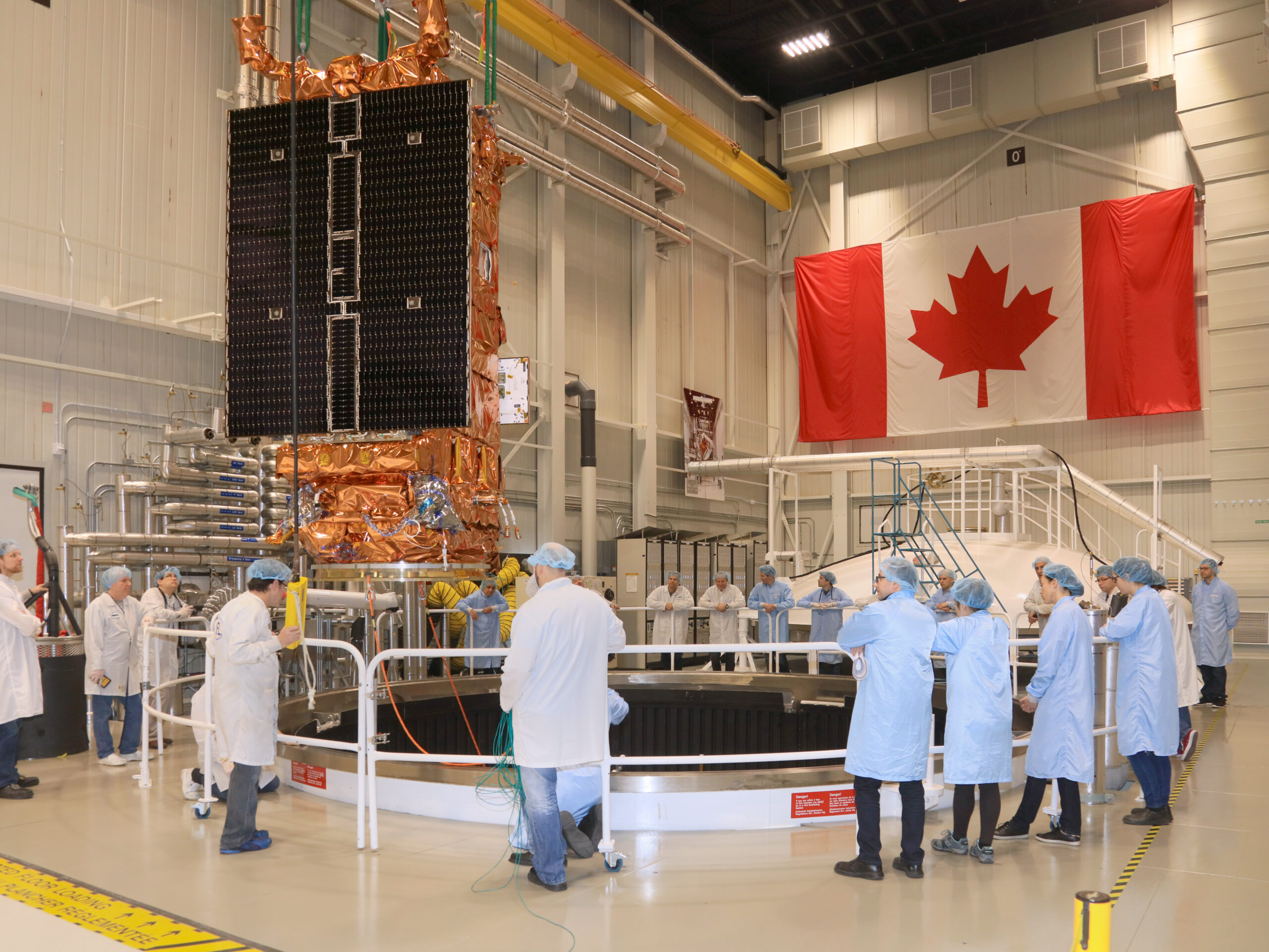
Canada’s budget boost for Radarsat is part of its climate strategy

Canada’s newly announced plan to invest 1 billion Canadian dollars ($739 million)  over the next 15 years in the Radarsat mission is part of the federal government’s climate resilience strategy. The Radarsat satellite series has been a pivotal component of Canada’s climate change strategy and international disaster response. It holds an even greater significance at a time when the country is grappling with unprecedented extreme weather events, all symptomatic of a changing climate.

Canada’s escalating warming rate, at twice the global average and over three times faster in its northern regions, as flagged by the federal government in 2019, makes the urgency of climate action even more apparent. These changes are no longer mere forecasts; they are now glaring realities that affect different parts of the nation, calling for immediate attention. According to Catastrophe Indices and Quantification Inc.,  2022 ranked as the third worst year for insured losses in the country’s history, while the total insured damages from severe weather events across the nation amounted to CA$ 3.1 billion in the past year.

In the face of this, Canada has adopted an aggressive climate strategy, reaffirming its commitment to lower emissions and combat climate change, introducing new programs, and fine-tuning its path to achieve net-zero emissions by 2050.

Satellite-based Earth observation is clearly a crucial tool in the government’s efforts to generate solutions for climate change mitigation and adaptation. The strategy for Earth observation, called Resourceful, Resilient, Ready: Canada’s Strategy for Satellite Earth Observation and unveiled in 2022, included an investment of CA$8 million in grants for 21 organizations across the country to advance innovative applications in Earth observation for sustainable development. 

Now, the hefty investment towards the Radarsat+ initiative, as announced Oct. 18 by Minister of Innovation, Science, and Industry Francois-Philippe Champagne in a live-streamed address delivered at the Space Canada annual industry conference in Ottawa, is focused on ensuring steady access to “crucial and high-quality Earth observation data”. The goal is simple: bolstering Canada’s resilience in the face of climate change and stepping up the capacity to respond to increasingly severe natural disasters.

Radarsat+ encompasses various projects, as Champagne explained, including the design, construction, and launch of a replacement satellite for the Radarsat Constellation Mission (RCM), as well as the initiation of a fourth-generation national sovereign satellite system to succeed the RCM. The mission will be a collaboration between the Canadian Space Agency (CSA) and the Canadian space industry.

Minister of Environment and Climate Change Steven Guilbeault also emphasized in a statement, “high-quality satellite data is crucial to Canada meeting its environmental goals.” 

As the effects of climate change and global warming accelerate, there is an increasing demand for timely and reliable Earth observation data, particularly with the rise in extreme weather events and natural disasters. 

In May, the government unveiled the National Risk Profile, Canada’s first-ever public, strategic national-level assessment of disaster risks. It provides a comprehensive national view of disaster risks, current emergency management resources, and measures in place to mitigate them. It is a crucial piece in the national Emergency Management Strategy, which outlines priorities to enhance emergency preparedness and reduce disaster risks. Satellite data is key to making science-based decisions — from climate change adaptation to building resilience in vulnerable areas such as Canada’s North.

As Champagne highlighted, “increasing the capability for satellite Earth observation means fostering a safer, more predictable environment in Canada”. 

Radarsat data is already part of Canada’s contributions to the 17-agency International Disasters Charter, which deploys satellite information in response to global crises, underscoring the significance of high-quality satellite data.

Radarsat+ will further empower Environment and Climate Change Canada to track sea ice patterns and monitor critical ecosystem health across the vast Canadian landscape.

Continuing the legacy

Canada’s commitment to the Radarsat program has deep roots, with the launch of the first Radarsat satellite in 1995 marking the beginning of the nation’s reputation as a global leader in radar satellite Earth observation. With the enhanced capabilities offered by Radarsat+, Canada is poised to maintain and strengthen this legacy.

Radarsat data is highly regarded and widely used by government stakeholders, including the Canadian military, civil and environmental officials, as well as international space agencies such as NASA and the European Space Agency.

The fresh infusion of funding in the Radarsat+ program, now with an enhanced annual budget of approximately CA$67 million, significantly enhances Earth observation capabilities beyond CSA’s average annual of about CA$500 million for all programs.

With the current Radarsat satellites aging, the new funding will serve a dual purpose. Firstly, Radarsat+ will introduce a fourth satellite to complement the three existing ones in the Radarsat Constellation Mission (RCM), which was developed by MDA and launched in 2019 and is expected to operate until 2026 without intervention. The addition of the fourth satellite will extend the timeline of the constellation. 

Additionally, the program will finance the definition phase of a successor mission, which Champagne described as a “fourth-generation national sovereign satellite system,” set to launch in the 2030s. This mission’s manufacturing and launch will require further funding in the upcoming years.

Key role in Arctic strategy

The Radarsat series also plays a central role in Canada’s Arctic strategy, where maritime monitoring is a significant challenge. The satellites complement other monitoring methods, such as aircraft and ships. 

However, it is crucial to note that “radar imagery satellites are at — or will reach — the end of their expected service lives long before the planned launch dates of the replacement satellites,” as was highlighted in a report by Auditor General Karen Hogan last year. The report also stressed the pressing need for new satellites due to “incomplete surveillance and insufficient data about vessel traffic in Canada’s Arctic waters.” The delay in renewing maritime monitoring infrastructure has reached a point where some assets may retire before replacements are available.

Originally projected for a 2035 launch, the new satellite’s readiness has become all the more imperative.

source

Peptide discovery could lead to better eczema treatments

Researchers have pinpointed a particular peptide’s role in activating atopic dermatitis, or eczema.

The work could lead to more effective treatments for the condition.

Atopic dermatitis (AD) is a skin condition characterized by itching and irritated and thickened skin at the site of the irritation. The brain natriuretic peptide (BNP) is a peptide, or short chain of amino acids, that is elevated in patients with AD.

“BNP is expressed in sensory neurons, the neurons responsible for conveying sensation to the brain via the spinal cord,” says Santosh Mishra, associate professor of molecular biomedical sciences at North Carolina State University and corresponding author of the work.

“We know from previous work that BNP helps translate the sensation of itch from the skin to the brain. In this work we wanted to see if BNP was involved in activating AD.”

In a chemically induced mouse model of AD, the researchers saw that mice without BNP did not exhibit the thickened or irritated skin commonly associated with AD, and their itching was reduced compared with control mice who did have BNP.

“The results show that BNP likely plays a role in itch activation,” Mishra says. “We next looked at BNP’s relationship to periostin, to see if we could determine how that activation takes place.”

Periostin is a protein that can interact with sensory neurons in skin to activate itch response. It is produced in skin cells called keratinocytes and fibroblasts. Keratinocytes in turn, have receptors for BNP, which are called NPR1 receptors. When the BNP receptors are activated, periostin is produced and itch can be turned on.

“But the interesting thing here is that the sensory neurons are the activator,” Mishra says. The neuron releases BNP, which activates keratinocytes with the NPR1 receptor, which then release the periostin.

“This work shows that peripheral neurons, not just central neurons, are playing a role in AD–it begins in the sensory neurons, and cascades from there,” Mishra says. “It also points to some potential therapeutic strategies, such as blocking BNP’s ability to bind to NPR1 receptors in the skin.”

The research appears as a letter to the editor in the Journal of Investigative Dermatology.

The National Institutes of Health supported the work.

Source: NC State

source

Lots of space launches alter metals in atmosphere

The Space Age is leaving fingerprints on one of the most remote parts of the planet. That has potential implications for climate, the ozone layer, and the continued habitability of Earth.

Using tools hitched to the nose cone of their research planes and sampling more than 11 miles above the planet’s surface, researchers have discovered significant amounts of metals in aerosols in the atmosphere, likely from increasingly frequent launches and returns of spacecraft and satellites. That mass of metal is changing atmospheric chemistry in ways that may affect Earth’s atmosphere and ozone layer.

“We are finding this human-made material in what we consider a pristine area of the atmosphere,” says Dan Cziczo, one of a team of scientists who published a study on these results in the Proceedings of the National Academy of Sciences. “And if something is changing in the stratosphere—this stable region of the atmosphere—that deserves a closer look.” Cziczo is professor and head of the department of earth, atmospheric, and planetary sciences at Purdue University.

Led by Dan Murphy, an adjunct professor in the same department and a researcher at the National Oceanic and Atmospheric Administration, the team detected more than 20 elements in ratios that mirror those used in spacecraft alloys. They found that the mass of lithium, aluminum, copper, and lead from spacecraft reentry far exceeded those metals found in natural cosmic dust. Nearly 10% of large sulfuric acid particles—the particles that help protect and buffer the ozone layer—contained aluminum and other spacecraft metals.

Samples from the stratosphere

Scientists estimate that as many as 50,000 more satellites may reach orbit by 2030. The team calculates that means that, in the next few decades, up to half of stratospheric sulfuric acid particles would contain metals from reentry. What effect that could have on the atmosphere, the ozone layer and life on Earth is yet to be understood.

Scientists have long suspected that spacecraft and satellites were changing the upper atmosphere, but studying the stratosphere, where we don’t live and even the highest flights enter only briefly, is challenging.

As part of NASA’s Airborne Science Program, Murphy and his group fly a WB-57 airplane to sample the atmosphere 11.8 miles (19 km) above the ground in Alaska, where circumpolar clouds tend to form. Similar measurements were made by Cziczo and his group from an ER-2 aircraft over the continental United States. Both groups use instruments hitched to the nose cone to ensure that only the freshest, most undisturbed air is sampled.

Like the view of the unruffled surface of the ocean, the stratosphere appears untroubled—at least to human eyes. Life and civilization take place mostly on the planet’s surface and in the troposphere, the atmosphere’s very lowest layer. The stratosphere is a surprisingly stable and seemingly serene layer of the atmosphere.

The stratosphere is also the realm of the ozone layer: that gaseous marvel that acts as a global tent to shield the planet and all life on it from the searing, scorching rays of ultraviolet radiation. Without the ozone layer, life would likely never have arisen on Earth. And without it, life is unlikely to be able to continue.

The last decades have been eventful for the stratosphere. The ozone layer came under threat from chlorofluorocarbons in the 1980s, and only coordinated, sustained global efforts of governments and corporations have begun to bear fruit in repairing and replenishing it.

“Shooting stars streak through the atmosphere,” Cziczo says. “Often, the meteor burns up in the atmosphere and doesn’t even become a meteorite and reach the planet. So the material it was made from stays in the atmosphere in the form of ions. They form very hot gas, which starts to cool and condense as molecules and fall into the stratosphere. The molecules find each other and knit together and form what we call meteorite smoke. Scientists recently started noticing that the chemical fingerprint of these meteoritic particles was starting to change, which made us ask, ‘Well, what changed?’ because meteorite composition hasn’t changed. But the number of spacecraft has.”

More and more space launches

Spacecraft launches, and returns, were once international events. The launches of Sputnik and the Mercury missions were front-page news. Now, a quickening tide of innovation and loosening regulation means that dozens of countries and corporations can launch satellites and spacecraft into orbit. All those satellites must be sent up on rockets—and most of that material, eventually, comes back down.

Like the wakes of great ships trolling through the ocean, rockets leave behind them a trail of metals that may change the atmosphere in ways scientists don’t yet understand.

“Just to get things into orbit, you need all this fuel and a huge body to support the payload,” Cziczo says. “There are so many rockets going up and coming back and so many satellites falling back through the atmosphere that it’s starting to show up in the stratosphere as these aerosol particles.”

Of course, shooting stars were the first space-delivery system. Meteorites fall through the atmosphere every day. The heat and friction of the atmosphere peel material off them, just as they do off human-made artifacts. However, while hundreds of meteors enter the Earth’s atmosphere every day, they are increasingly being rivaled by the mass of metals that comprise the tons of Falcon, Ariane, and Soyuz rockets that boost spacecraft into space and return to Earth’s surface.

“Changes to the atmosphere can be difficult to study and complex to understand,” Cziczo says. “But what this research shows us is that the impact of human occupation and human spaceflight on the planet may be significant—perhaps more significant than we have yet imagined. Understanding our planet is one of the most urgent research priorities there is.”

Source: Purdue University

source

Upgraded star trackers could give more satellites a debris-monitoring role

TAMPA, Fla. — New star-tracking sensors in the works would enable all manner of satellites to keep an eye out for hazardous orbital debris too small to detect from the ground.

Star trackers use the known position of stars to help keep satellites properly oriented and pointing in the right direction. 

Belgian spacecraft component specialist Arcsec is working with Portuguese space traffic management venture NeuraSpace on a debris-spotting star tracker they expect to demo in space by 2025.

Adding data from Arcsec’s sensors to the pool of information NeuraSpace gathers from public sources and partnerships with ground telescope providers would enable the Portuguese venture to track much smaller orbital debris, according to NeuraSpace chief operating officer Chiara Manflett.

Meanwhile, Jacksonville, Florida-based Redwire has developed a star tracker it says can be used to detect debris, slated to be on orbit in the next three to six months after entering production this summer.

Other manufacturers are also looking into developing star trackers that satellite operators could use for debris detection alongside attitude and orbit control.

More tools for debris hunters

Denver-based, national security-focused satellite maker True Anomaly announced plans in August to use Redwire SpectraTRAC star trackers and cameras, which would work in concert for spacecraft dedicated to chasing, and imaging, uncooperative objects up close.

Redwire senior vice president Don Wesson declined to disclose other customers for SpectraTRAC, but said the object detection feature enables space domain awareness applications including debris detection, rendezvous and proximity operations, and space situational awareness.

Customers can opt for the object detection feature at time of purchase or anytime in the future, he said, even during their mission and without being paired up with a Redwire camera.

While Arcsec CEO Tjorven Delabie said enabling debris-monitoring on Arcsec star trackers already in orbit could be done with a software upgrade from the ground, he said the company is still figuring out how best to reallocate the star tracker’s internal computing power to accommodate this capability.

The Belgian company’s work to upgrade star trackers follows a recent 1.3 million euro ($1.4 million) grant from the European Innovation Council.

Converting trackers

Star trackers Arcsec and others provide can already pick up non-celestial objects passing through their field of view, but this data is often discarded to conserve onboard computational power.

Luis Gomes, CEO of small satellite specialist AAC Clyde Space, said operational constraints are one of the main reasons his company has not sought to add the capability to its star trackers.

Most star trackers operated for attitude control do not generate imagery on a routine basis, Gomes said, and operators only run them in that mode when things go wrong because it is labor-intensive.

“I suppose it would be possible to change the algorithms on [star tracker] processors to also detect debris,” he said, “but that is not the first thing I would consider doing with our limited computational resources.”

Arcsecc would need to convince star tracker customers who do not track debris as part of their main mission to feed this data into NeuraSpace’s platform — either through new orders or by retrofitting satellites already in orbit via software upgrades. 

Arcsec has delivered 50 star trackers since its founding in 2020, mostly to commercial cubesats up to 150 kilograms in low Earth orbit (LEO), and two have been launched to space so far.

“It’s a very small cost for them” to add the debris-tracking capability to their star tracker, Delabie said, “but it is a bit of a cost in terms of data budget.”

He said Arcsecc is looking into various incentives, including compensating star tracker customers for collecting and sharing debris data with NeuraSpace.

Giving a satellite a debris-monitoring role would improve the operator’s brand image, he added.

Arcsec’s partnership with the Portuguese venture provides another way to convert star tracker users into debris watchdogs.

“If one of our customers were to have Arcsec sensors onboard, then they would get a better service,” NeuraSpace’s Manflett said, because insights would come from their own sensors and not just the broader network.

A NeuraSpace customer with a compatible star tracker would get better conjunction analysis and maneuver suggestions from the space traffic management platform. 

NeuraSpace recently announced it is serving customers that collectively control more than 250 satellites in orbit, including one operated by Earth observation provider Dragonfly Aerospace.

In addition to commercial satellite operators, NeuraSpace is seeking to sign up satellite manufacturers, subsystem providers, insurance carriers, regulators, and policymakers to its platform.

Improving accuracy

Because star trackers are typically optimized to detect bright stars, their ability to detect dark debris particulates is limited. 

Under perfect conditions, Arcsec’s star trackers should be able to pick up debris in LEO down to three centimeters depending on its reflectivity, Delabie said, while currently available systems are only able to catalog objects down to around 10 centimeters accurately.

Redwire’s Wesson said SpectraTRAC’s object-detection capabilities are also dependent on the brightness of the reflected object — influenced by its size, shape, and distance — and would perform in a similar manner to Arcsec star trackers under ideal conditions. 

Even a tiny piece of space debris poses a threat to space missions and assets.

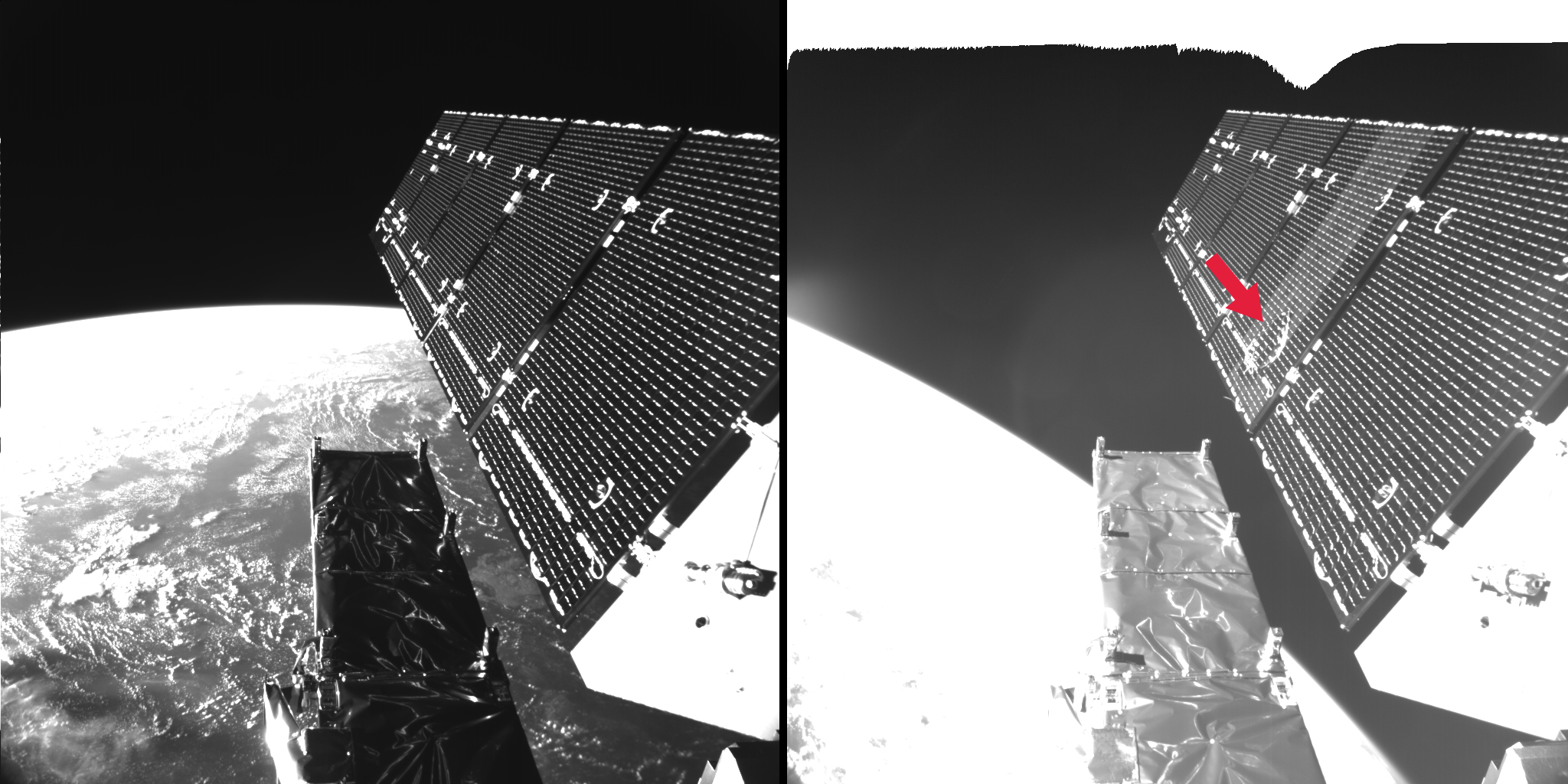
In 2016, The European Space Agency said a particle a few millimeters size hit one of two 10-meter-long solar panels on its Copernicus Sentinel-1A Earth observation satellite, damaging an area 40 centimeters in diameter and causing a small, albeit manageable loss of power.

A collision with a similar-sized particle can be a life-ending event for smaller cubesats. 

Although manufacturers such as SpaceX are working to make their satellites less reflective to reduce light pollution, Delabie said he expects these efforts will continue to focus on surfaces facing Earth, and not all the angles Arcsec sensors would view.

Even more rudimentary observations would improve orbit calculations for improving space safety, according to Arcsec and NeuraSpace, as ventures including NorthStar, Vyoma, and Digantara plot dedicated constellations with better sensors to track debris.

Leveraging equipment operators are already taking with them to space also promises a faster way to add debris-tracking data nodes into the mix.

source

Greenspace protects health at cellular level—but with limits

Greenspace has a positive impact on a key genetic marker associated with exposure to stress, a study finds.

However, the study also finds that the positive impact of greenspace—the vegetation in a neighborhood’s yards, parks, and public spaces—isn’t enough to compensate for other environmental challenges like air pollution.

“Greenspace is tremendously valuable for a community, but it is not enough to overcome systemic racism…”

The markers in question are telomeres, which are sections of repetitive DNA found at each end of a chromosome that serve to protect the ends of the chromosomes from damage. However, each time a cell divides, the telomeres inside those cells become slightly shorter. Once the telomeres become so short that the cell cannot divide successfully, the cell dies.

“This makes telomeres important markers of biological age, or how worn down our cells are,” says Scott Ogletree, corresponding author of the study and a former postdoctoral researcher at North Carolina State University’s Center for Geospatial Analytics. “And we know that many variables—such as stress—can influence how quickly our telomeres wear down.” Ogletree is now a lecturer at the University of Edinburgh.

“There’s a lot of research that talks about the various ways in which greenspace is beneficial, and a lot of research that talks about adverse health effects associated with pollution, racist segregation in housing, and other social and environmental challenges,” says Aaron Hipp, coauthor of the study and a professor of parks, recreation, and tourism management at NC State. “This study was an attempt to quantify the beneficial impacts of greenspace at the cellular level, and the extent to which greenspace can help to offset environmental harms.”

For the study, researchers drew on data from the CDC’s National Health and Nutrition Examination Survey (NHANES) for the years 1999-2002. NHANES is a longitudinal, nationally representative study that assesses the health of the United States population through interviews and physical examinations.

Specifically, the researchers looked at data on 7,827 people that allowed them to assess their demographic data, the length of their telomeres, and where they lived. The research team assessed the amount of greenspace in each person’s neighborhood and how that related to their telomere length. The researchers also accounted for potential confounding variables, such as lifestyle, health history, and substance use. In addition, the researchers identified a suite of other environmental variables that could affect telomere length, such as air quality and redlining maps that track historically segregated neighborhoods.

“We found that the more greenspace people had in their neighborhoods, the longer their telomeres were,” says Hipp, who is also the associate director of social and behavioral science applications at NC State’s Center for Geospatial Analytics. “That was true regardless of race, economic status, whether they were drinkers or smokers, etc.”

“That’s the good news,” Ogletree says. “However, when we accounted for other characteristics of each neighborhood—air pollution, segregation, or ‘deprivation’—the positive effect of the greenspace essentially disappeared. Deprivation, in this context, was an overarching variable that included the neighborhood-level data on income, education, employment status, and housing conditions. In other words, while greenspace seems to help protect telomere length, the harm from other factors appears to offset that protection.”

“Greenspace is tremendously valuable for a community, but it is not enough to overcome systemic racism and the effects of economic segregation and environmental justice challenges on its own,” says Hipp. “This study drives home the idea that creating greenspace in a community is important, but it’s as crucial—or more crucial—for us to address environmental harms, particularly those tied to systemic racism.”

The paper appears in the journal Science of the Total Environment. Coauthors are from NC State; Montgomery County Parks Department in Maryland the National Institute of Environmental Health Sciences (NIEHS); and the University of Calgary.

The work had support from NIEHS via NC State’s Center for Human Health and the Environment.

Source: NC State

source

Blueprint for an In-Space Community

Whether for research, entertainment, media, hotels, warehouses, or fuel depots, let’s locate in the same orbit and inclination.

ONE OF THE MOST EXCITING NEW MARKETS IN THE SPACE SECTOR IS POISED FOR LIFTOFF. Privately owned space stations, backed by investors and strategic partners, will soon be a reality. Implemented correctly, a dramatic new era of in-space manufacturing, research, entertainment, and tourism will be unleashed.  

NASA has declared 2030 as the end date for the International Space Station (ISS). To kick off this new era, Congress has provided initial funding to stimulate the development of these next-generation space stations.  

The immediate goal is to ensure continued U.S. leadership in the nascent space marketplace by avoiding a U.S. space station gap. It is expected that by 2030 there will be two stations in orbit from the teams that have received the initial NASA funding. The stakes could not be higher. China’s Tiangong space station is already in orbit and luring international customers.

But the longer goal is more expansive: by unleashing the creativity of the commercial sector, we can fully tap the unique environment of space for advances in Ag-Tech, biopharma, genetics, thin films and other cutting-edge fields of research and manufacturing.  

How to begin?

First, we recognize the need for space agencies as the driving customer at the outset — this is a new market, and the government is a proven customer. NASA’s plan is to be one of many customers for the commercial space stations — a formula proven in the decade-long transition from the single-point dependency on the Space Shuttle to today’s commercial launch provider ecosystem, with multiple cargo vehicles and crew services to the ISS. This pivot to NASA as a customer has been a resounding success for the taxpayer, for industry, and, importantly, for government access to this strategically important region. We all know of Elon Musk’s and Jeff Bezos’ launch companies — but there are dozens of smaller companies offering a range of launch services. The good news is that as the cost of space transportation continues to decrease, the flexibility in delivery options has increased. Just as open markets would predict.    

Location, Location, Location

NASA’s Reagan-era Space Station Freedom concept was baselined for a 28.5-degree orbital inclination relative to the equator. When Russia joined the program in 1993, the expanded and renamed International Space Station was located at 51.6 degrees to make it more accessible from Russian and other international launch sites. Credit: NASA/Tom Buzbee

For the coming era of private space stations, as in any real-estate project, it is all about location, location, location.

Orbital mechanics is a complex science, but a few basic principles should drive business decisions. The current ISS location, at 51.6 degrees above the equator, is not cost-efficient. It takes more fuel to reach a higher inclination orbit and less cargo capacity as well. There are also fewer optimal launch sites that service the current ISS orbital location. To put it bluntly, the ISS orbit is in the wrong location for commercial space stations. This is not a trivial disadvantage. It is estimated that transportation costs for both crew and cargo represent significantly more than half of the operating costs of any commercial station. That represents hundreds of millions of dollars of costs over the life of any space station.  

Knowing these challenges, why was the ISS orbit placed at 51.6 degrees? The answer lies in the geopolitics of the mid-1990s, where the U.S. was grappling with the collapse of the Soviet Union and the desire to integrate the newly formed Russia’s impressive space program into a partnership with NASA.  

I saw the motivation firsthand. I was ‘in the room’ for many of those discussions. In the mid-1990s, the Clinton administration embraced replacing Ronald Reagan’s Space Station Freedom with having Russia as a full partner in the ISS. The inclusion of the Russian program served two purposes. First, to stem the brain drain from the collapsed Soviet Union. Second, it provided the United States with backup launch capabilities. We were single-point dependent on the Space Shuttle.  

Was this the right political decision for the 1990s? Yes. Is this the right decision for today’s commercial era? No.

So, what is the right location?  

Launching due east at 28.5 degrees from Cape Canaveral is the most efficient route. However, this orbit limits Earth observation opportunities, which is a major market driver for the industry. Considering slightly higher orbits increases the marketable Earth observation while still considering transportation costs.  

The optimal orbit? Somewhere between 38-45 degrees north of the Equator. 

An orbit in this range will allow fuel-efficient cargo missions from Cape Canaveral, Wallops Island in Virginia, as well as from Vandenberg in California. This location also benefits crew and cargo launch from nations like Japan and India and for expected future European capabilities. 

Critical Mass

Selecting the right orbit is only the first step in realizing maximum commercial sustainability.  

Multiple stations are expected in the coming decade. And a cluster of stations in the same orbital inclination would allow for shared resources and on-orbit services. Consider this a space town that lowers both the costs and risks for the in-space landlords and the visiting astronauts.  

I’d like to invite all American space station entrepreneurs, whether a free-flying station through NASA’s Commercial Low-Earth Orbit Destinations (CLD) program, such as those from Voyager Space and Airbus, Blue Origin and Sierra Nevada, or Northrop Grumman, or a startup venture such as Vast, and planned global station operators to consider coming together in a single chosen orbit. Let’s create a cost-efficient commercial zone, freed from the political heritage of the earlier era of space exploration. Whether for research, entertainment, media, hotels, warehouses, or fuel depots, let’s locate in the same orbit and inclination.  

By locating together, station operators could co-buy cargo and crew vehicles, thus reducing the costs. Investors would welcome the risk reduction from both diverse transportation and increased in-space services.  

Let’s seize the opportunity to create the first town in space, founded by stations owned and operated by the growing international community. We have the opportunity not to just replicate the International Space Station, but to power a true in-space economy.   

Let’s begin the conversation.   


Jeffrey Manber is president of international and space stations at Voyager Space and chairman of the board for Nanoracks. Manber was the co-founder and first employee of Nanoracks and previously served as the chief executive officer from 2009 until 2021. He also served as the CEO of MirCorp, which was the first commercial venture to send humans into space with no governmental funding. The views here are his own.

source