Raytheon selects Lockheed Martin bus for U.S. Space Force missile-tracking satellite

Raytheon’s infrared sensing payload will be integrated on a Lockheed Martin LM400

WASHINGTON — Raytheon Intelligence & Space announced Jan. 4 it selected a Lockheed Martin bus to build a missile-tracking satellite for the U.S. Space Force.

The U.S. Space Systems Command selected two satellite designs — one by Raytheon and the other by Millennium Space Systems — for a planned constellation of sensors in medium Earth orbit (MEO) to detect and track ballistic and hypersonic missiles. Both companies’ proposals last year cleared Space Force design reviews.

The Pentagon is adding a layer of MEO satellites to the nation’s missile-defense architecture to provide extra eyes on enemy hypersonic missiles. Compared to current sensors in geostationary satellites, sensors in medium orbits would see closer to Earth and track a wider area than satellites in low Earth orbit.  

Raytheon won a contract of undisclosed value to develop a prototype satellite, ground systems and data processing applications. 

“This is an advanced solution to counter emerging missile threats facing our country,” said Roger Cole, executive director of strategic systems at Raytheon Intelligence & Space. 

Raytheon’s infrared sensing payload will be integrated on a Lockheed Martin LM400, a new medium-size satellite bus the company introduced in 2021 with security features aimed at the military market.

“Lockheed Martin is excited to provide our mid-sized, rapidly-producible LM400 bus to Raytheon,” said Mike Corriea, vice president of Lockheed Martin’s overhead persistent infrared mission area. 

A “system critical design review” is scheduled for 2023, and the goal is to deliver the satellite for a 2026 launch. Work for this program will be performed at Raytheon’s facilities in El Segundo, California, and Lockheed Martin’s in Aurora, Colorado. 

source

Animals that carry seeds help regenerate forests

Animals are crucial to reforestation, research finds.

And yet, the world’s wildlife populations have declined by almost 70% in the last 50 years as humans have destroyed and polluted habitats.

Efforts to restore forests have often focused on trees, but a new study in the journal Philosophical Transactions that animals play a key role in the recovery of tree species by carrying a wide variety of seeds into previously deforested areas.

Sergio Estrada-Villegas, a postdoctoral associate at the Yale School of the Environment, led the study with Liza Comita, professor of tropical forest ecology. The project examines a series of regenerating forests in central Panama spanning 20 to 100 years post-abandonment.

“When we talk about forest restoration, people typically think about going out and digging holes and planting seedlings,” Comita says. “That’s actually not a very cost-effective or efficient way to restore natural forests. If you have a nearby preserved intact forest, plus you have your animal seed dispersers around, you can get natural regeneration, which is a less costly and labor-intensive approach.”

The research team analyzed a unique, long-term data set from the forest in Barro Colorado Nature Monument in Panama, which the Smithsonian Tropical Research Institute oversees, to compare what proportion of tree species in forests were dispersed by animals or other methods, like wind or gravity, and how that changes over time as the forest ages. The team focused on the proportion of plants dispersed by four groups of animals: flightless mammals, large birds, small birds, and bats.

Because the area has been intensely studied by biologists at the Smithsonian for about a century, the research team was able to delve into data stemming back decades, including aerial photographs taken in the 1940s-1950s. The area also presents a unique view into forests where there is very little hunting or logging. The results offer the most detailed data of animal seed dispersal across the longest time frame of natural restoration, according to the study.

The role of flightless animals in seed dispersal across all forest ages, from 20 years to old growth, and the variety of animal species involved were among the most important findings of the study and point to the importance of natural regeneration of forests, Comita and Estrada-Villegas say. In tropical forests, more than 80% of tree species can be dispersed by animals.

The researchers say the findings can serve as a road map for natural regeneration of forests that preserve biodiversity and capture and store carbon at a time when the UN Decade of Restoration is highlighting the need for land conservation, and world leaders are working to mitigate climate change stemming from fossil fuel emissions.

Forests soak up carbon dioxide from the atmosphere and store it in biomass and soils. Tropical forests, in particular, play an important role in regulating global climate and supporting high plant and animal diversity, the researchers note.

Estrada-Villegas, an ecologist who studies both bats and plants, says the study highlights how crucial animals are to healthy forests.

“In these tropical environments, animals are paramount to a speedy recovery of forests,” says Estrada-Villegas.

Coauthors are from the Max Planck Institute for Animal Behavior; the Universidad de los Andes in Bogota, Columbia; the Smithsonian Tropical Research Institute in Balboa, Panama; and Clemson University.

Source: Yale University

source

NASA faces budget crunch for extended Earth science missions

WASHINGTON — NASA will allow three aging Earth science missions to participate in an upcoming senior review of extended missions even as the agency warns of budget pressures on its overall portfolio of missions.

During a town hall Dec. 15 at the Fall Meeting of the American Geophysical Union, NASA officials said they agency had invited the Aqua, Aura and Terra missions to submit proposals in the 2023 senior review of Earth science missions that are in their extended phases.

The three spacecraft, launched between 1999 and 2004, remain functional but are running low on stationkeeping propellant. The spacecraft have started to drift from their original operational orbits, which prompted concerns about impacts on the science they can perform and data continuity.

Julie Robinson, deputy director of NASA’s Earth science division, said the agency collected feedback about those missions through a request for information and a virtual workshop in November attended by more than 500 people. “One outcome of that is that Terra, Aqua and Aura will be invited to the senior review,” she said. In a senior review, missions that have completed their original prime missions make the case for continued funding to extend their missions.

Being invited to the senior review, though, is no guarantee that the missions will be able to secure funding. Robinson said the upcoming senior review will be particularly challenging given limited funding available for mission extensions.

“The senior review is not going to be an easy one this year,” she said. “We don’t have the money in the budget to extend every mission that comes to the senior review.” The agency will ask the panel that reviews the mission to advise it on various trades it can make among the missions.

NASA requested more than $2.4 billion for Earth science in its fiscal year 2023 budget proposal. However, the omnibus spending bill enacted in late December provided just under $2.2 billion for Earth science. While that is an increase of $130 million from 2022, it comes as NASA is ramping up work on its line of Earth System Observatory missions and other projects.

At the town hall, one scientist said it was “pretty shocking” that NASA would even consider not extending those three missions given their performance and the community of researchers using data from them. Robinson again turned to financial challenges facing the overall Earth science program.

“In the case of Terra, Aqua and Aura, one of the challenges we have is that these systems, because they’ve been operating so long, they’re really expensive,” she said. NASA’s fiscal year 2023 budget request projected spending $30.7 million each on operations of Terra and Aqua and $20.5 million on Aura. One part of the senior review will be to look at reducing those operating costs, but she did offer an estimate of the range of potential reductions.

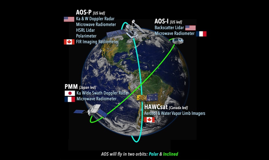
Those efforts come as NASA grapples with potential cost increases with the Earth System Observatory, notably the Atmosphere Observing System (AOS). An independent review found that AOS as currently designed is likely to cost $2.4 billion, $500 million more than NASA’s own estimate. That could force NASA to scale back or replace two AOS instruments.

“There are really painful trades in Earth System Observatory. There are also painful trades in deciding how much money to put on extended missions and how to operate them,” she said. “I can promise we will never make everybody happy with those trades.”

source

Independent review warns of cost growth on key Earth science mission

WASHINGTON — An independent review warned of potential cost overruns on a future major NASA Earth science mission, prompting NASA to consider removing some instruments from it.

NASA is in the process of conducting reviews known as Key Decision Point (KDP) A for three elements of its Earth System Observatory line of missions: Atmosphere Observing System (AOS), Mass Change, and Surface Biology and Geology. The KDP-A reviews would allow the proposed missions to move into Phase A of initial development.

NASA, though, delayed the KDP-A review for AOS, which had been scheduled for December, after receiving an independent review of the Earth System Observatory effort commissioned by NASA in June and completed in October. That review concluded that AOS, which will include satellites both in polar and mid-inclination orbits, would cost $2.4 billion, $500 million more than the project’s own estimate.

“That is a warning that got a lot of attention at the agency level,” said Julie Robinson, deputy director of NASA’s Earth science division, during a town hall meeting about the mission at the Fall Meeting of the American Geophysical Union Dec. 16. “It’s a red flag.”

A major factor for the cost growth in the opinion of the independent review board (IRB) is the low technical maturity of two instruments planned for it, a dual-band Doppler radar that would operate at Ka and W bands, and a high spectral resolution (HSRL) lidar. The radar would enable measurements of clouds and precipitation, while the lidar would characterize aerosols in the atmosphere.

While the independent review suggested saving money by replacing the dual-band with a single-band one, and the HSRL lidar with a more conventional lidar, Robinson said it was too early in the development of AOS to make that decision.

“We really need more time to study it,” she said, something that can be done during Phase A of AOS. That includes studies on building the instruments in-house versus procuring them, and requests for information to assess industry’s capability to provide those instruments.

NASA now plans to hold the KDP-A review in January, a delay she said was primarily intended to coordinate work among centers involved in AOS as well as international partners. Canada and Japan are providing their own spacecraft for AOS, along with instruments from France.

The prospect of removing the dual-band radar and HSRL lidar had alarmed scientists, who worried it would significantly reduce the scientific productivity of AOS. Robinson agreed, but noted the agency had not made any decisions about those instruments. “The IRB report did discuss that these descopes are significant, and we recognize that as well. This is not what you were hoping to get out of this mission,” she said. “We have to do these Phase A studies.”

However, she said that the agency needed to find some way to reduce the cost of AOS to avoid cuts elsewhere in the overall Earth System Observatory. “If it would really be half a billion dollars more than is budgeted to do AOS,” she said, “then we would need to drop another mission.”

The independent review concluded the costs of the other two missions, Mass Change and Surface Biology and Geology, were close to project estimates: $454 million for Mass Change and $752 million for Surface Biology and Geology. The review, though, warned that Mass Change, which it described as a “near-copy” of the current GRACE-FO mission, carries risks from using that design and doesn’t improve on resolution and sampling as recommended by the Earth science decadal survey.

NASA initiated the Earth System Observatory effort in 2021, using it as the umbrella for the missions that will implement the five “designated observables” from the decadal survey: aerosols; clouds, convection and precipitation; mass change in snow, ice and water; surface biology and geology; and surface deformation and change. AOS will handle the aerosols and clouds, convection and precipitation observables.

The agency has not started formal planning yet for the mission to implement the fifth designated observable, surface deformation and change. Instead, NASA will use data from the NASA-ISRO Synthetic Aperture Radar (NISAR) mission scheduled for launch in 2024 to support science involving surface deformation and change.

source

Climate change will make Atlantic tropical storms worse

A warming climate will increase the number of tropical cyclones and their intensity in the North Atlantic, potentially creating more and stronger hurricanes, according to simulations using a high-resolution, global climate model.

“Unfortunately, it’s not great news for people living in coastal regions,” says Christina Patricola, an Iowa State University assistant professor of geological and atmospheric sciences, an affiliate of the US Department of Energy’s Lawrence Berkeley National Laboratory in California, and a study leader.

“Atlantic hurricane seasons will become even more active in the future, and hurricanes will be even more intense,” Patricola says.

The researchers ran climate simulations using the Department of Energy’s Energy Exascale Earth System Model and found that tropical cyclone frequency could increase 66% during active North Atlantic hurricane seasons by the end of this century.

Those seasons are typically characterized by La Niña conditions—unusually cool surface water in the eastern tropical Pacific Ocean—and the positive phase of the Atlantic Meridional Mode—warmer surface temperatures in the northern tropical Atlantic Ocean.

The projected numbers of tropical cyclones could increase by 34% during inactive North Atlantic hurricane seasons. Inactive seasons generally occur during El Niño conditions with warmer surface temperatures in the eastern tropical Pacific Ocean and the negative phase of the Atlantic Meridional Mode with cooler surface temperatures in the northern tropical Atlantic Ocean.

In addition, the simulations project an increase in storm intensity during the active and inactive storm seasons.

“Altogether, the co-occurring increase in (tropical cyclone) number and strength may lead to increased risk to the continental North Atlantic in the future climate,” the researchers write.

Patricola adds: “Anything that can be done to curb greenhouse gas emissions could be helpful to reduce this risk.”

What are North Atlantic tropical cyclones? “Tropical cyclone is a more generic term than hurricane,” Patricola says. “Hurricanes are relatively strong tropical cyclones.”

Exactly, says the National Oceanic and Atmospheric Administration. Tropical cyclone is a general reference to a low-pressure system that forms over tropical waters with thunderstorms near the center of its closed, cyclonic winds. When those rotating winds exceed 39 MPH, the system becomes a named tropical storm. At 74-plus MPH, it becomes a hurricane in the Atlantic and East Pacific oceans, a typhoon in the northern West Pacific.

Patricola and another group of collaborators have also published a second research paper about tropical cyclones, also in Geophysical Research Letters. The paper examines a possible explanation for the relatively constant number of tropical cyclones observed globally from year to year.

Could it be that African Easterly Waves, low pressure systems over the Sahel region of North Africa that take moist tropical winds and raise them up into thunderclouds, are a key to that steady production of storms?

Using regional model simulations, the researchers were able to filter out the African Easterly Waves and see what happened.

As it turned out, the simulations didn’t change the seasonal number of Atlantic tropical cyclones. But, tropical cyclones were stronger, peak formation of the storms shifted from September to August, and the formation region shifted from the coast of North Africa to the Gulf of Mexico.

So African Easterly Waves many not help researchers predict the number of Atlantic tropical cyclones every year, but they do appear to affect important storm characteristics, including intensity and possibly where they make landfall.

Both papers call for more study.

“We are,” Patricola says, “chipping away at the problem of predicting the number of tropical cyclones.”

Source: Iowa State University

source

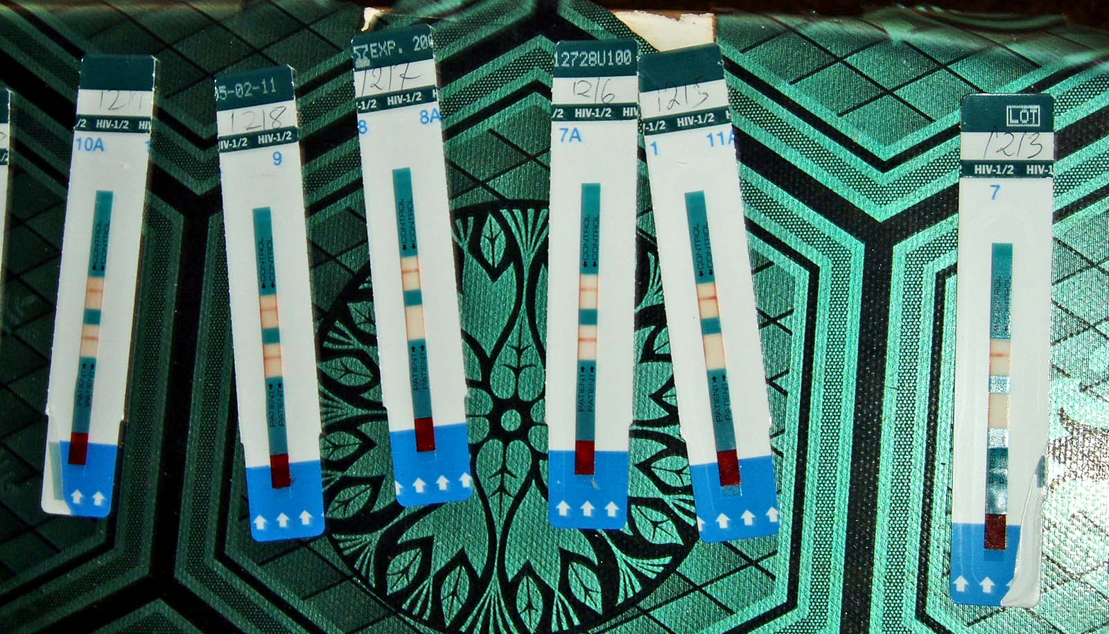
To prevent HIV, ease intimate partner violence

Women in Sub-Saharan Africa who experience recent intimate partner violence are three times more likely to contract HIV, according to new research.

“Worldwide, more than one in four women experience intimate partner violence in their lifetime,” says McGill University Professor Mathieu Maheu-Giroux, a Canada Research Chair in Population Health Modeling.

“Sub-Saharan Africa is among one of the regions in the world with the highest prevalence of both IPV and HIV. We wanted to examine the effects of intimate partner violence on recent HIV infections and women’s access to HIV care in this region,” he says.

Their study, published in The Lancet HIV, shows considerable overlap between violence against women and the HIV epidemics in some of the highest burdened countries. Among women living with HIV, those experiencing intimate partner violence were 9% less likely to achieve viral load suppression—the ultimate step in HIV treatment.

“The 2021 UN General Assembly, attended and supported by the Government of Canada, adopted the Political Declaration on HIV and AIDS with bold new global targets for 2025. This encompasses a commitment to eliminate all forms of sexual and gender-based violence, including IPV, as a key enabler of the HIV epidemic. Improving our understanding of the relationships between IPV and HIV is essential to meet this commitment,” says Maheu-Giroux.

The researchers found that physical or sexual intimate partner violence in the past year was associated with recent HIV acquisition and less frequent viral load suppression. According to the researchers, IPV could also pose barriers for women in getting HIV care and remaining in care while living with the virus.

“Given the high burden of IPV worldwide, including in Canada, the need to stem the mutually reinforcing threats of IPV and HIV on women’s health and well-being is urgent,” says Salome Kuchukhidze, a PhD candidate studying epidemiology and the lead author of the research.

Source: McGill University

source

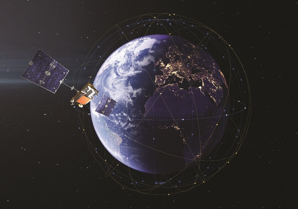
Iridium and Qualcomm to bring satellite connectivity to smartphones this year

TAMPA, Fla. —Iridium unveiled chip maker Qualcomm Jan. 5 as the partner behind plans to connect smartphones to its satellite constellation this year.

U.S.-based Qualcomm has developed a product called Snapdragon Satellite, which it said can be added to Android smartphones and other devices to support two-way communications via Iridium satellites.

Potential uses include emergency SOS services, SMS texts, and other low-bandwidth messaging applications in areas outside terrestrial networks and where Iridium’s global constellation is licensed to operate.

Any emergency messages would be routed through response teams run by Garmin, a GPS technology specialist and longtime Iridium partner.

Jordan Hassin, Iridium’s executive director of communication, acknowledged widespread speculation in the run-up to the announcement about South Korean smartphone maker Samsung being its direct-to-smartphone partner.

At one point Iridium was also rumored to be working with Apple, which in September announced a partnership with Iridium’s rival Globalstar for services currently limited to SOS.

However, rather than partnering with a specific smartphone vendor, Hassin said Iridium chose to team up with Qualcomm to enable its technology in multiple smartphone brands that run Android, the most popular operating system for mobile phones.

In addition to supporting hardware development, Qualcomm has an agreement to sell the service to companies on Iridium’s behalf.

Qualcomm’s chipsets are already commonly used in Samsung, Motorola, and other smartphone brands worldwide. 

To connect to Iridium’s 66-strong constellation in low Earth orbit, smartphone makers would need to integrate the latest generation of a Qualcomm chipset that is geared toward premium phones.

Hassin said “several” Android customers are already integrating Snapdragon Satellite, with the first products expected to be released in the second half of 2023.

In a media briefing, Iridium CEO Matt Desch said it is still “being worked out” how and if smartphone customers would be charged for using its satellite-enabled services.

Apple has said it will offer satellite-enabled SOS services on its range of iPhone 14 smartphones for free for two years.

Francesco Grilli, vice president of product management at Qualcomm Technologies, told the briefing the company successfully demonstrated Snapdragon Satellite Jan. 4 in Las Vegas as part of the Consumer Electronics Show (CES).

He said the company was able to send basic text messages in an average of three seconds with a smartphone during the demo. 

While the service will initially target smartphones, the companies said they are considering expanding to other devices, including laptops, tablets, vehicles, and small Internet of Things machines.

Desch said the company could also consider upgrading its capabilities to add higher bandwidth services later, in line with other businesses that are also looking to enter the direct-to-smartphone market.

“We certainly have aspirations to go well beyond where we are today,” he said.

In addition to Apple and Globalstar, other companies seeking to provide direct-to-smartphone services from LEO include SpaceX in partnership with T-Mobile, AST SpaceMobile, Lynk Global, and Sateliot.

In July, Qualcomm announced plans with Swedish telecoms equipment maker Ericsson and French aerospace company Thales to demonstrate 5G on smartphones via LEO satellites.

However, Grilli said these plans are still in the research and development phase, and any commercial services would require spectrum and hundreds of new satellites to become a reality.

He said it is unlikely Qualcomm’s venture with Ericsson and Thales would “see any product before 2026 at the earliest,” and that is optimistic.

source

NorthStar raises $35 million for debris-tracking satellites

TAMPA, Fla. — Canada’s NorthStar Earth and Space said Jan. 5 it has raised $35 million ahead of plans to deploy its first three satellites this year for tracking objects in orbit.

U.S.-based private equity firm Cartesian Capital led the Series C funding round, which NorthStar CEO Stewart Bain said brings the total amount the company has raised to nearly $100 million.

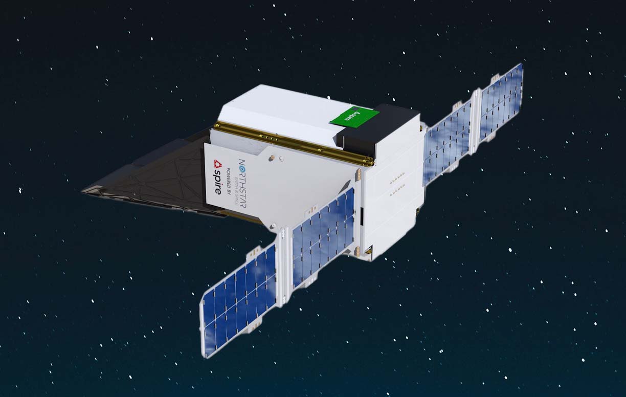
NorthStar aims to use proceeds to accelerate plans for a constellation of 24 Space Situational Awareness (SSA) satellites, which would scan out from low Earth orbit (LEO) to track other satellites and debris. 

The company hopes to track objects as small as one centimeter in LEO, about seven centimeters in medium Earth orbit (MEO) and “somewhere between 50 and 40” centimeters even farther out in geostationary orbit (GEO), Bain said in an interview.

Spire Global is building the first three satellites for NorthStar, each the size of 16 cubesats, for a launch around the middle of 2023 with Virgin Orbit.

Bain said it had not been decided whether these satellites would be deployed from Virgin Orbit’s base in California, or be part of the air-launch company’s first batch of missions from England.

NorthStar’s contract with Spire includes options for up to 30 satellites, and Bain said the company is now looking at “when to pull the trigger” on the next set of spacecraft.

“It’ll probably be another set of three,” he said, “and then after that we’ll probably do them in blocks of six.”

There “is an argument to be made of letting the first few get up, see how they operate, and then pushing the button on the next set,” he added, “or leading that by a certain amount of time” to help ensure the timely delivery of parts amid the industry’s supply chain issues.

The first three satellites have already secured commitments from a mix of commercial and government customers, according to Bain, although he declined to disclose them.

He said a U.S. government pilot project that picked NorthStar and five other commercial firms in December to prototype space traffic data platforms helped highlight commercial SSA opportunities and attract business.

“It’s not like we weren’t already contacting both government and private sector operators,” he said, “but that really got people to wake up and say, wow, here we go.”

Luxembourg-based satellite operator SES last year announced plans to use NorthStar’s data to help manage its fleet of satellites in GEO and MEO.

Bain said a space development fund supported by SES and Luxembourg’s government participated in NorthStar’s Series C funding round.

Other investors included the government of Quebec and a family-owned Canadian technology fund called Telesystem Space.

source

‘Semi-sub’ vehicle is tricky to detect

A semi-submersible vehicle may prove that the best way to travel undetected and efficiently in water is not on top, or below, but in between.

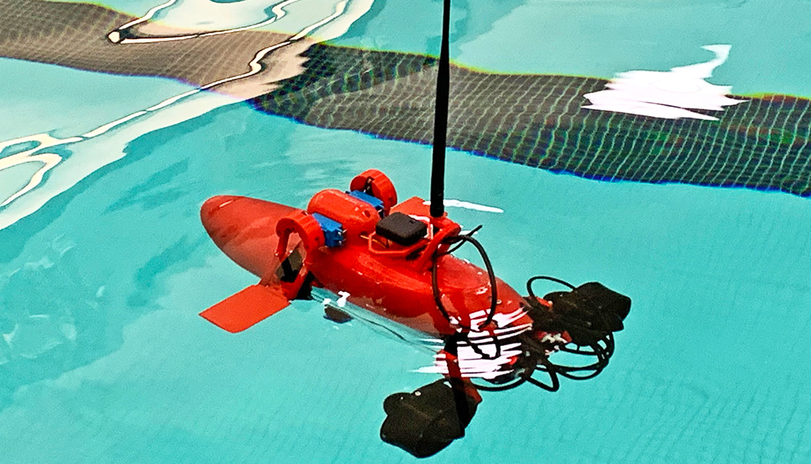
The roughly 1.5-foot-long semi-sub prototype, built with off-the-shelf and 3D-printed parts, showed its seaworthiness in water tests, moving quickly with low drag and a low profile.

The researchers detailed the test results in a study in the journal Unmanned Systems.

This vessel-type isn’t new. Authorities have discovered crudely made semi-subs being used for illicit purposes in recent years, but researchers aim to demonstrate how engineer-developed half-submerged vessels can efficiently serve military, commercial, and research purposes.

“A semi-submersible vehicle is relatively inexpensive to build, difficult to detect, and it can go across oceans,” says Konstantin Matveev, a professor of engineering at Washington State University who led the work.

“It’s not so susceptible to waves in comparison to surface ships since most of the body is underwater, so there are some economic advantages as well.”

Since the semi-sub sails mostly at the water line, it does not need to be made of as strong materials as a submarine which has to withstand the pressure of being underwater for long periods of time. The semi-sub also has the advantage of having a small platform in contact with the atmosphere, making it easier to receive and transmit data.

For this study, Matveev and coauthor Pascal Spino, a recent Washington State graduate, piloted the semi-sub in Snake River’s Wawawai Bay in Washington state. They tested its stability and ability to maneuver.

The semi-sub reached a max speed of 1.5 meters per second (roughly 3.4 miles an hour), but at higher speeds, it rises above the water creating more of a wake and expending more energy. At lower speeds, it is almost fully immersed and barely makes a ripple.

The researchers also outfitted the semi-sub with sonar and mapped the bottom of a reservoir near Pullman, Washington to test its ability to collect and transmit data.

While not yet completely autonomous, the semi-sub can be pre-programmed to behave in certain ways, such as running a certain route by itself or responding to particular objects by pursuing them or running away.

While the semi-sub is relatively small at 450 mm long with a 100 mm diameter (about 1.5 foot long and 4 inches in diameter), Matveev says it is possible for larger semi-subs to be built to carry significant cargo. For instance, they could be used to help refuel ships or stations at sea. They could even be scaled up to rival container ships, and since they experience less drag in the water, they would use less fuel creating both an environmental and economic advantage.

For now, Matveev’s lab is continuing work on optimizing the shape of semi-submersible vehicle prototypes to fit specific purposes. He is currently collaborating with the US Naval Academy in Annapolis, Maryland to work on the vehicles’ operational capabilities and compare numerical simulations with results from experiments.

Source: Washington State University

source

2D material may lead to sharper phone photos

A new type of active pixel sensor that uses a novel 2D-material may enable ultra-sharp cell phone photos and create a new class of extremely energy-efficient Internet of Things sensors, researchers say.

“When people are looking for a new phone, what are the specs that they are looking for?” says Saptarshi Das, associate professor of engineering science and mechanics at Penn State and lead author of the paper in Nature Materials.

“Quite often, they are looking for a good camera, and what does a good camera mean to most people? Sharp photos with high resolution.”

Most people just snap a photo of a friend, a family gathering, or a sporting event, and never think about what happens “behind the scenes” inside the phone when one snaps a picture. There is quite a bit happening to enable you to see a photo right after you take it, and this involves image processing, Das says.

“When you take an image, many of the cameras have some kind of processing that goes on in the phone, and in fact, this sometimes makes the photo look even better than what you are seeing with your eyes. These next generation of phone cameras integrate image capture with image processing to make this possible, and that was not possible with older generations of cameras.”

However, the great photos in the newest cameras have a catch—the processing requires a lot of energy.

“There’s an energy cost associated with taking a lot of images,” says Akhil Dodda, a graduate research assistant at Penn State at the time of the study who is now a research staff member at Western Digital, and co-first author of the study.

“If you take 10,000 images, that is fine, but somebody is paying the energy costs for that. If you can bring it down by a hundredfold, then you can take 100 times more images and still spend the same amount of energy. It makes photography more sustainable so that people can take more selfies and other pictures when they are traveling. And this is exactly where innovation in materials comes into the picture.”

Low light phone photos

The innovation in materials outlined in the study revolves around how the researchers added in-sensor processing to active pixel sensors to reduce their energy use. So, they turned to a novel 2D material, which is a class of materials only one or a few atoms thick, molybdenum disulfide. It is also a semiconductor and sensitive to light, which makes it ideal as a potential material to explore for low-energy in-sensor processing of images.

“We found that molybdenum disulfide has very good photosensitive response,” says Darsith Jayachandran, graduate research assistant in engineering and mechanics and co-first author of the study. “From there, we tested it for the other properties we were looking for.”

These properties included sensitivity to low light, which is important for the dynamic range of the sensor. The dynamic range refers to the ability to “see” objects in both low light such as moonlight and bright light such as sunlight. The human eye can see stars at night better than most cameras due to having superior dynamic range.

Molybdenum disulfide also demonstrated strong signal conversion, charge-to-voltage conversion and data transmission capabilities. This makes the material an ideal candidate to enable an active pixel sensor that can do both light sensing and in-sensor image processing.

“From there, we put the sensors into an array,” Jayachandran says. “There are 900 pixels in a nine square millimeter array we developed, and each pixel is about 100 micrometers. They are much more sensitive to light than current CMOS sensors, so they do not require any additional circuitry or energy use. So, each pixel requires much less energy to operate, and this would mean a better cell phone camera that uses a lot less battery.”

Internet of Things benefits

The dynamic range and image processing would enable users to take sharp photos in a variety of adverse conditions for photography, according to Das.

“For example, you could take clearer photos of friends outside at night or on a rainy or foggy day,” Das says. “The camera could do denoising to clear up the fog and the dynamic range would enable say a night photo of a friend with stars in the background.”

Along with enabling a top-rate phone camera in the future, the team also envisions their improved sensor technology could have other applications. This would include better light sensors for Internet of Things (IoT) and Industry 4.0 applications.

Industry 4.0 is the term for a growing movement that combines traditional industry practices and cutting-edge digital technology such as the Internet of Things, cloud data storage, and artificial intelligence/machine learning. The goal is to improve manufacturing by developing more efficient processes and practices through intelligent automation, and sensors are key.

“Sensors that can see through machines while in operation and identify defects are very important in the IoT,” Dodda says. “Conventional sensors consume a lot of energy so that is a problem, but we developed an extremely energy efficient sensor that enables better machine learning, etc. and saves a lot in energy costs.”

The Department of Defense and the National Science Foundation supported the work.

Source: Penn State

source